South Downtown (SODO) Subarea Plan
Shaping the Future of South Downtown's Easton Memorial Hospital Site
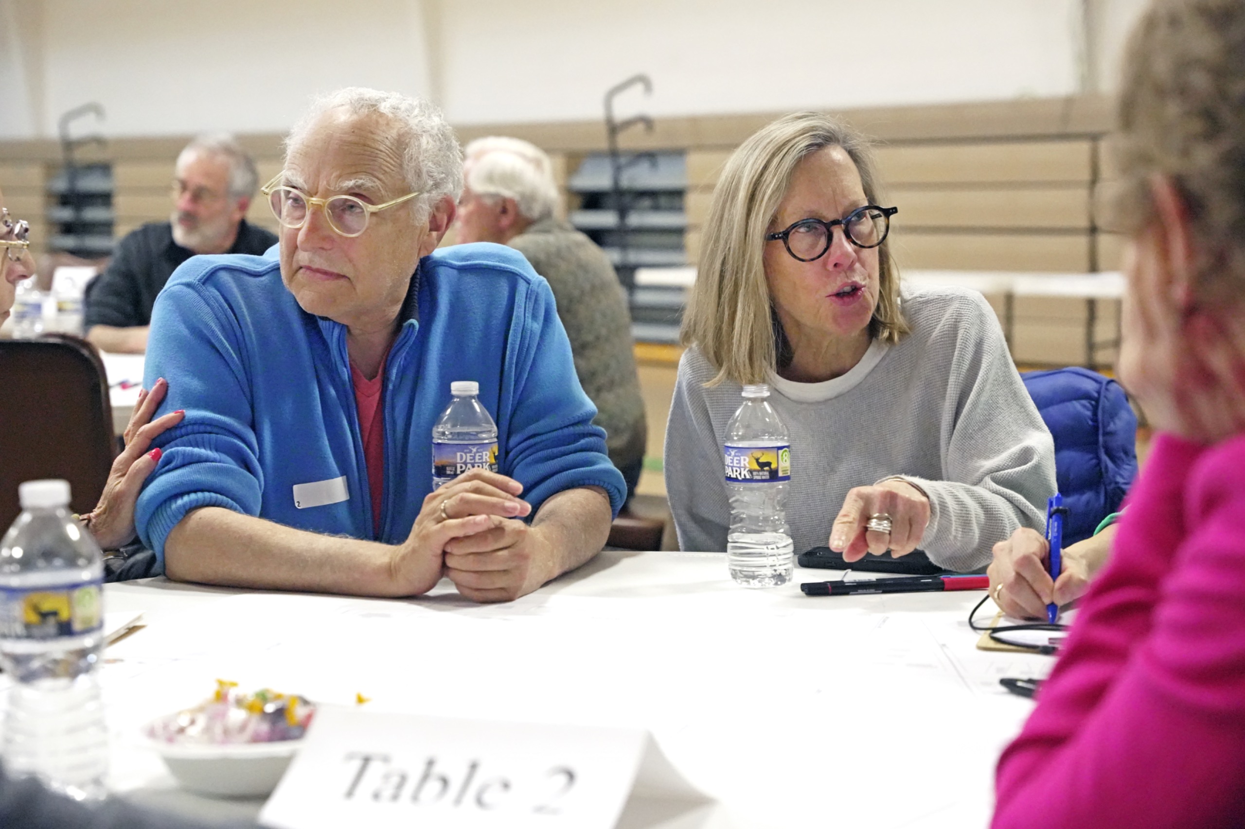
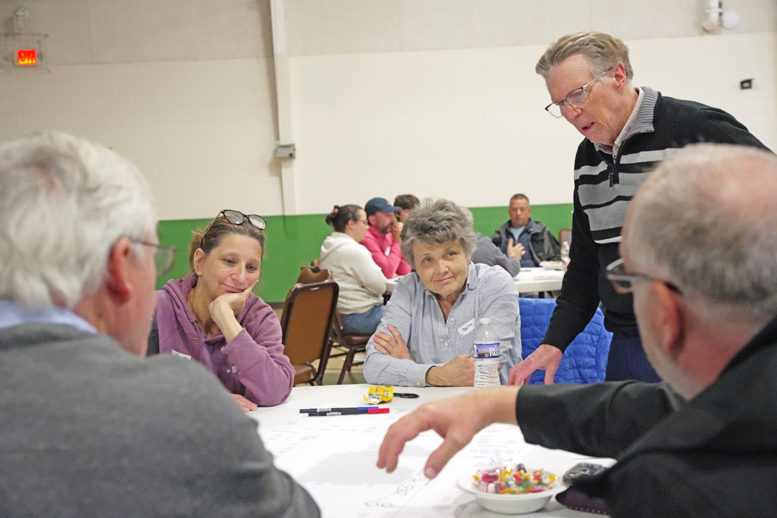
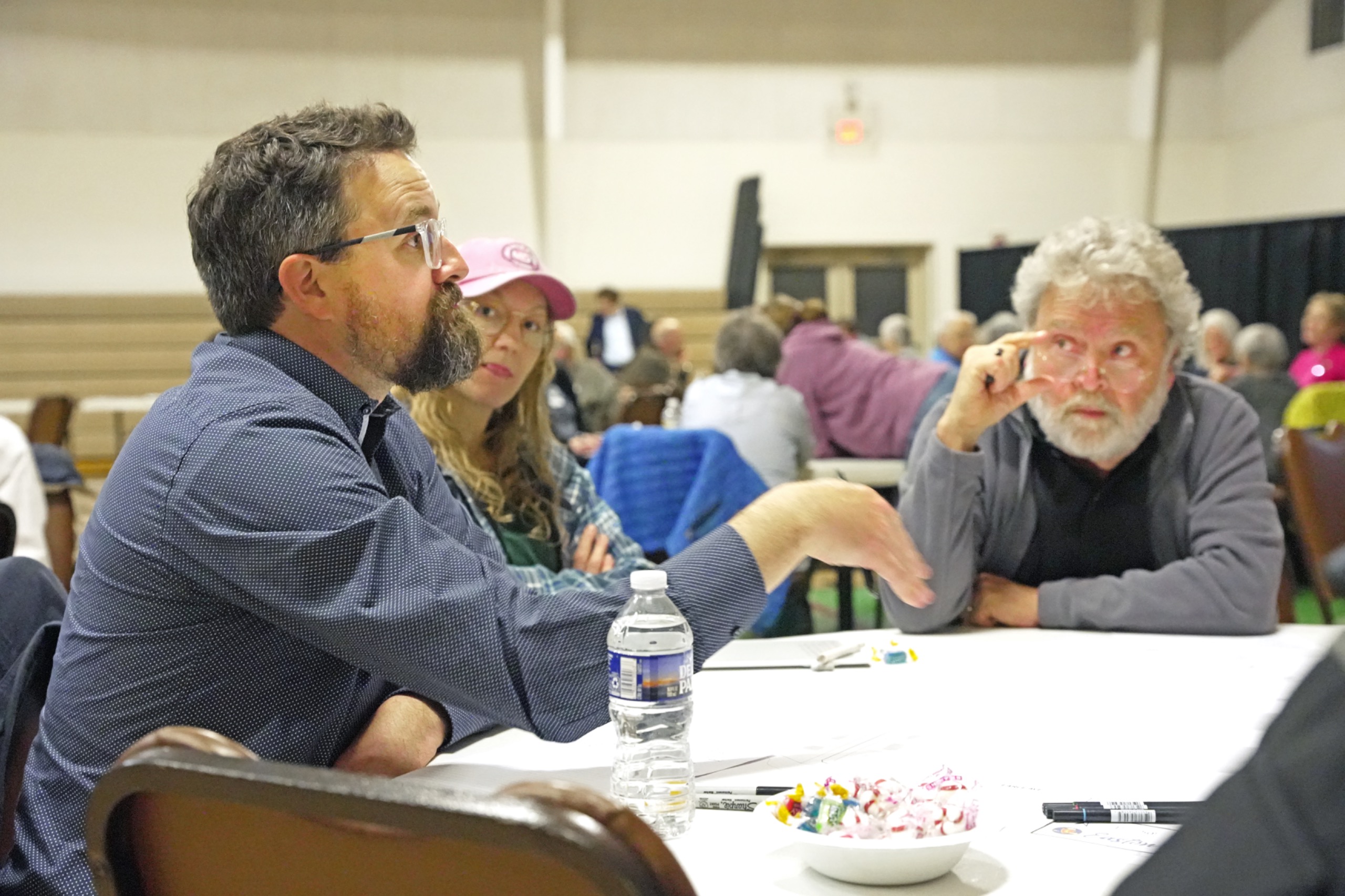
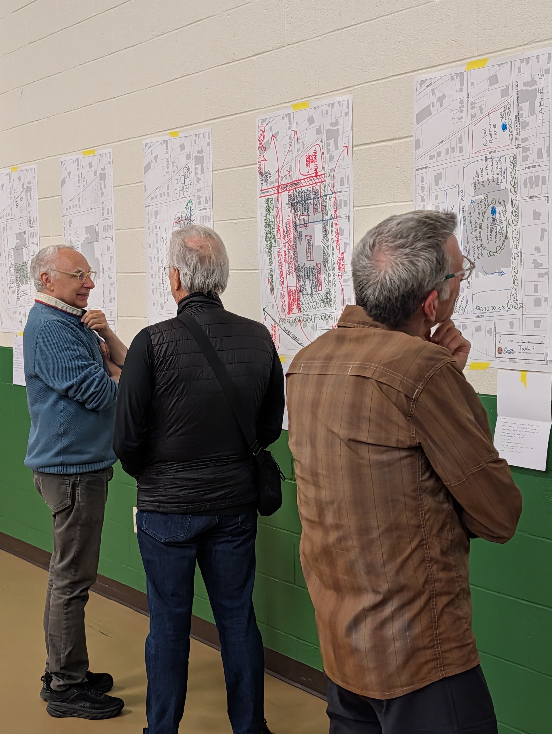
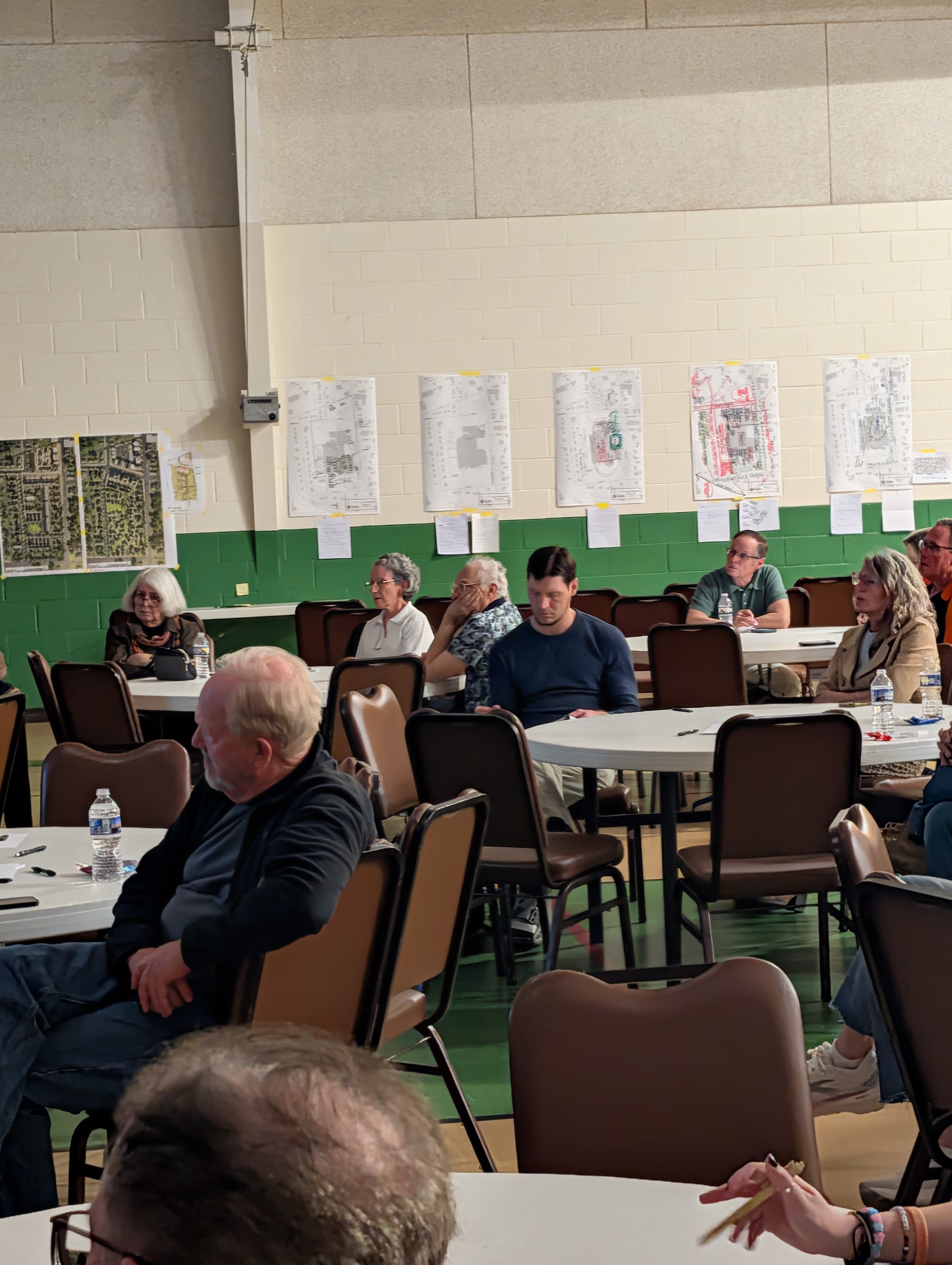
The April 19 - 23 Design Charrette is now complete!
Thank you to all who participated!
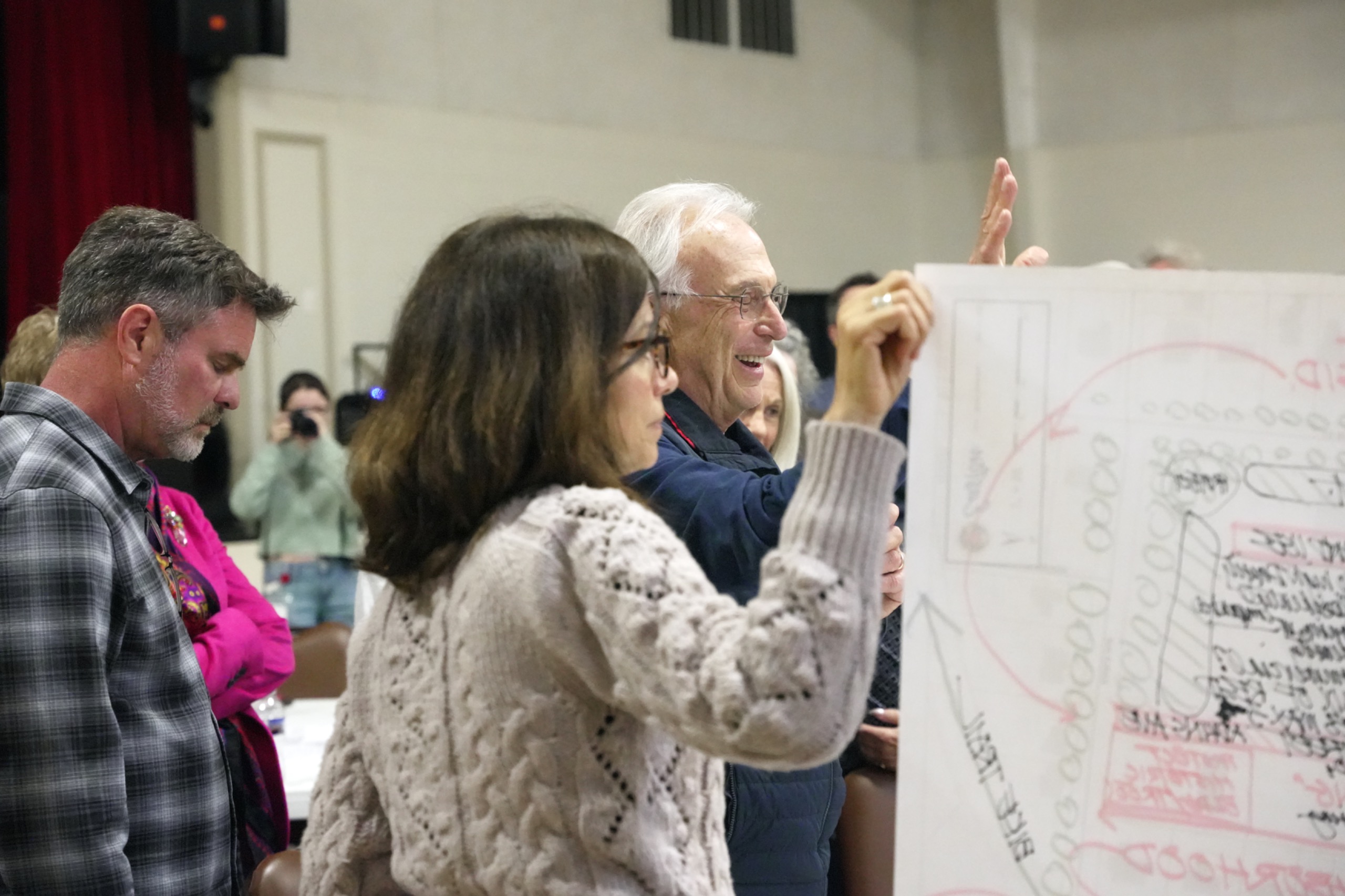
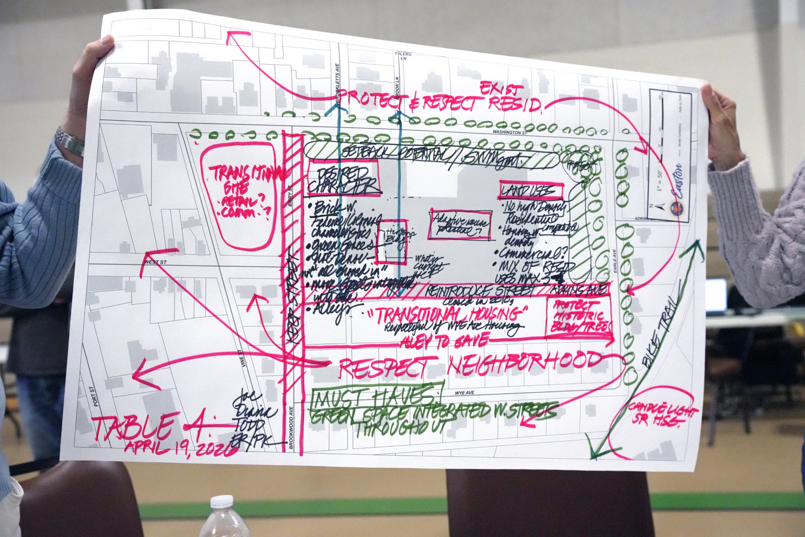
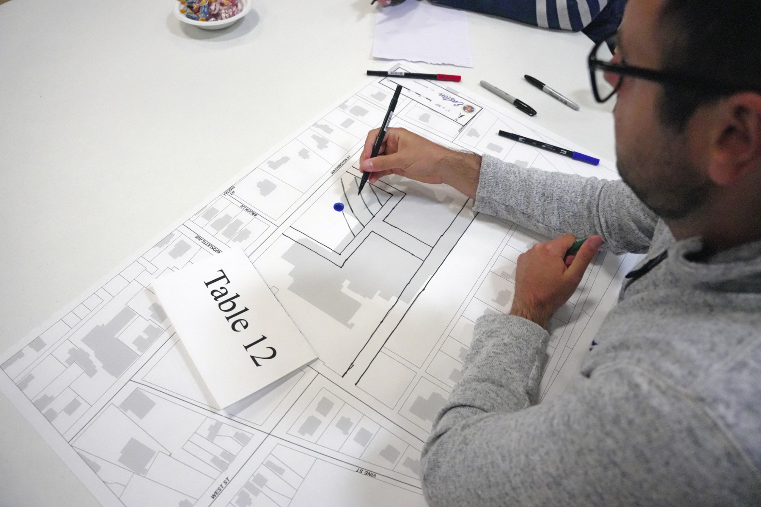
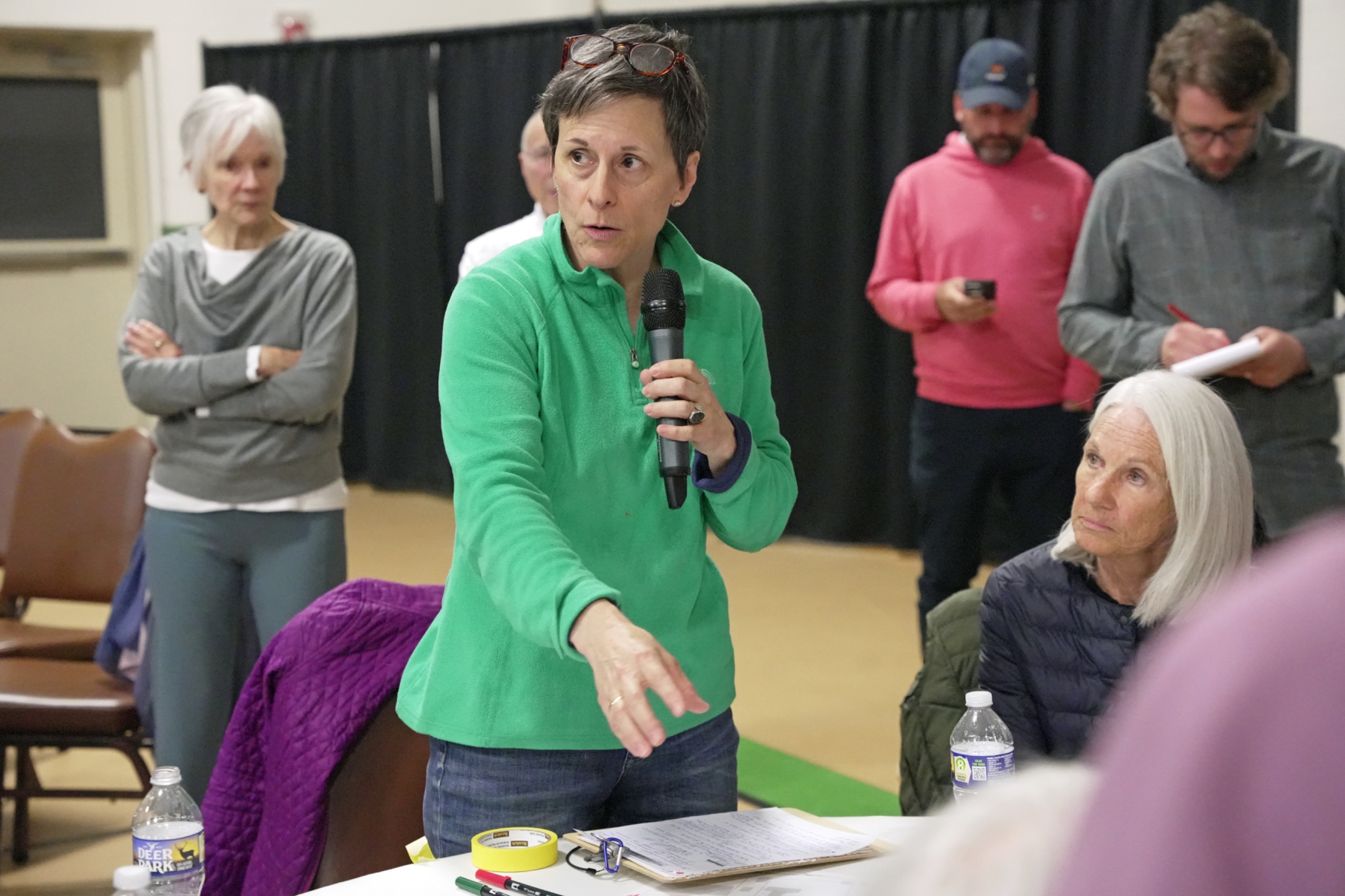
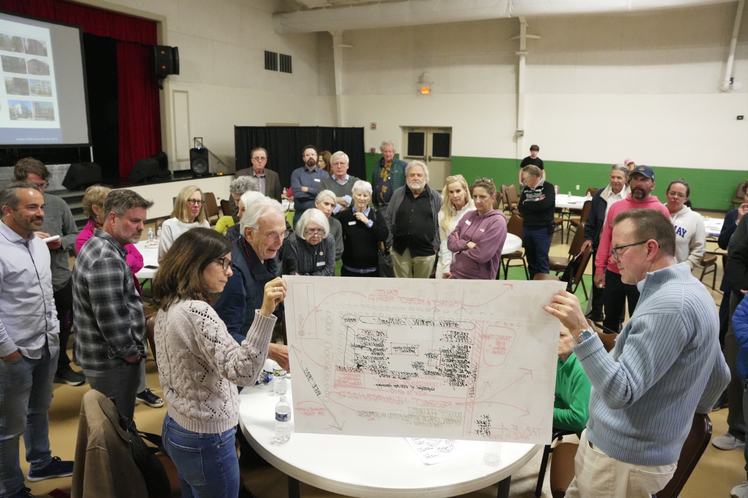
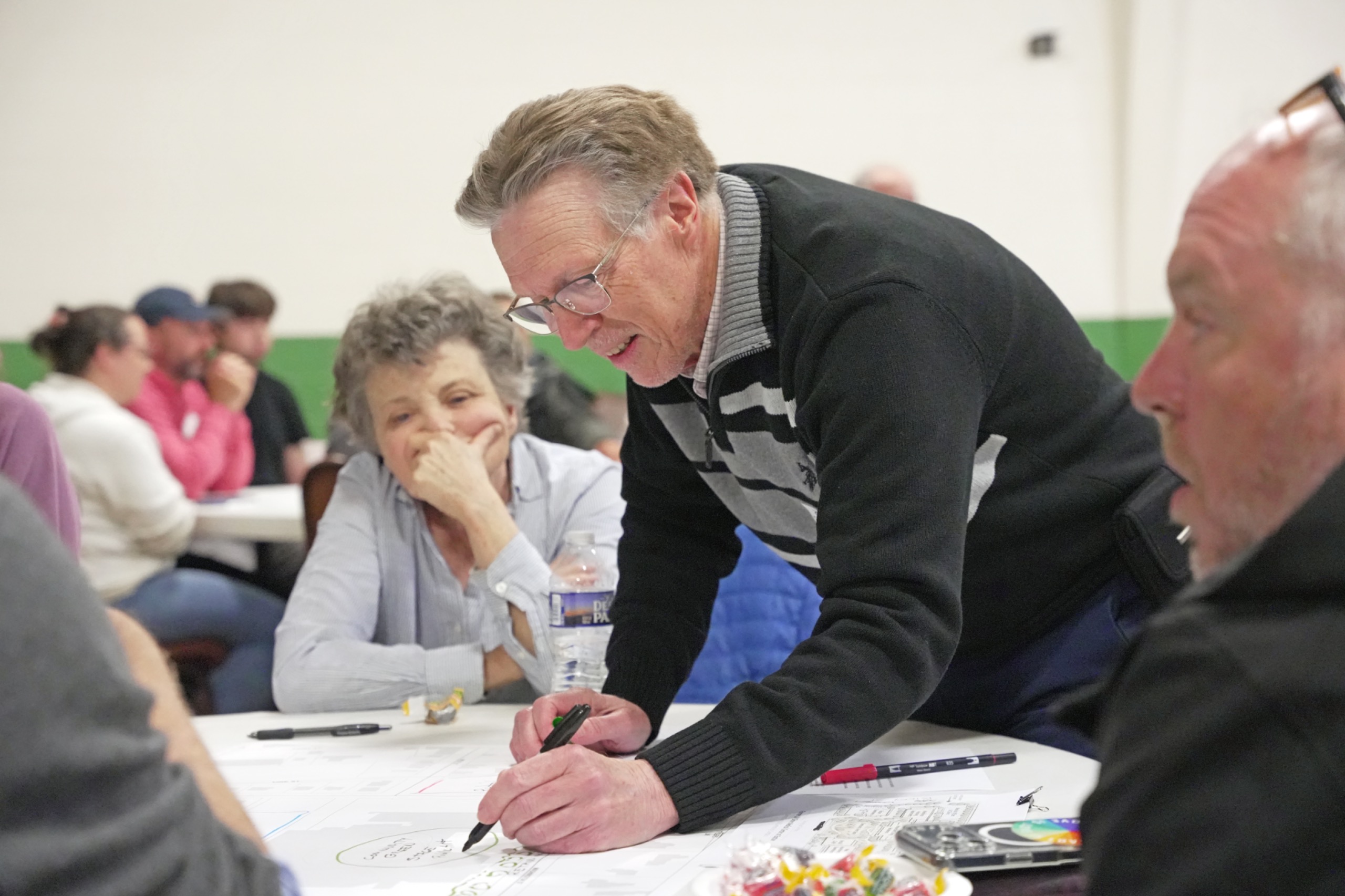
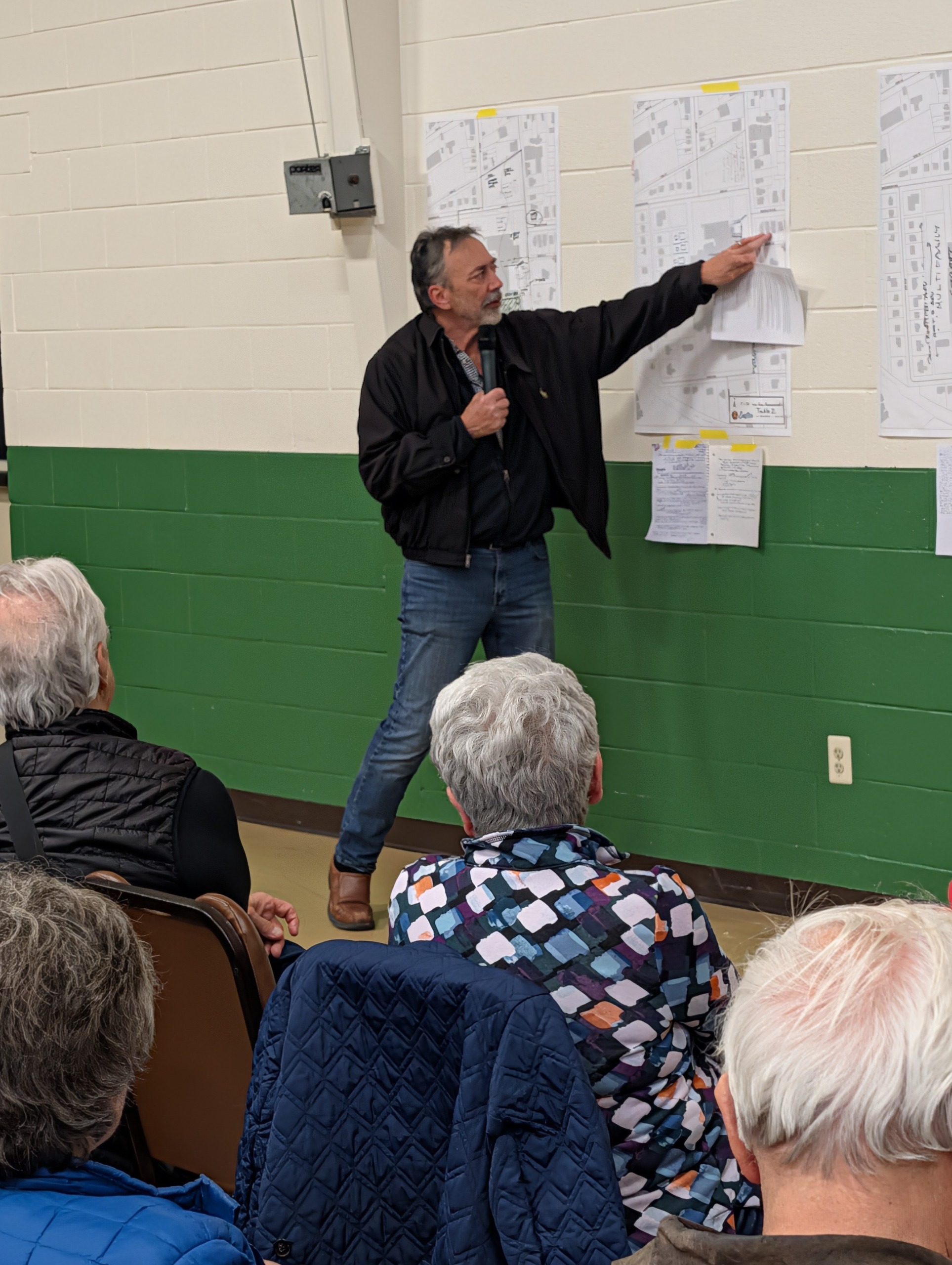
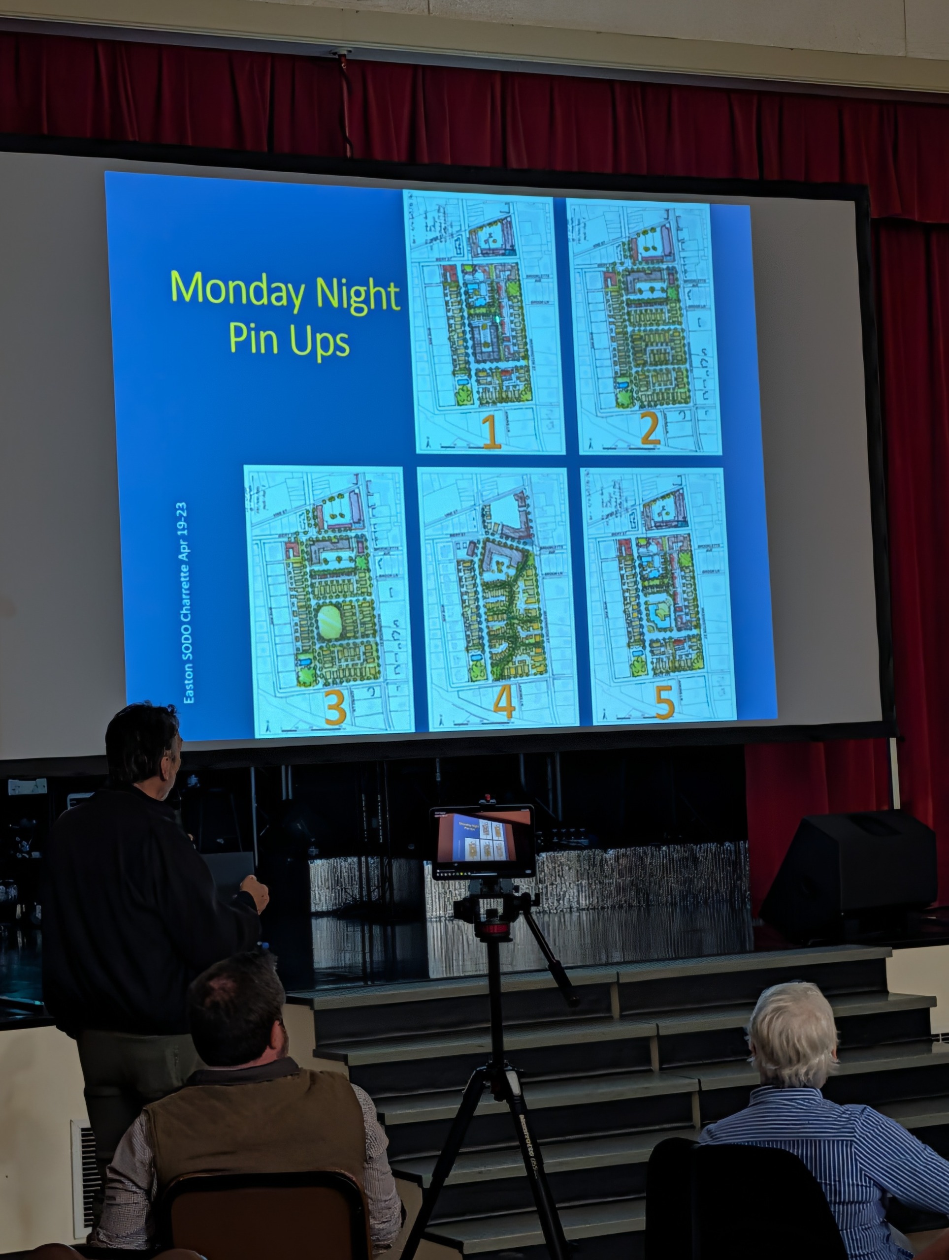
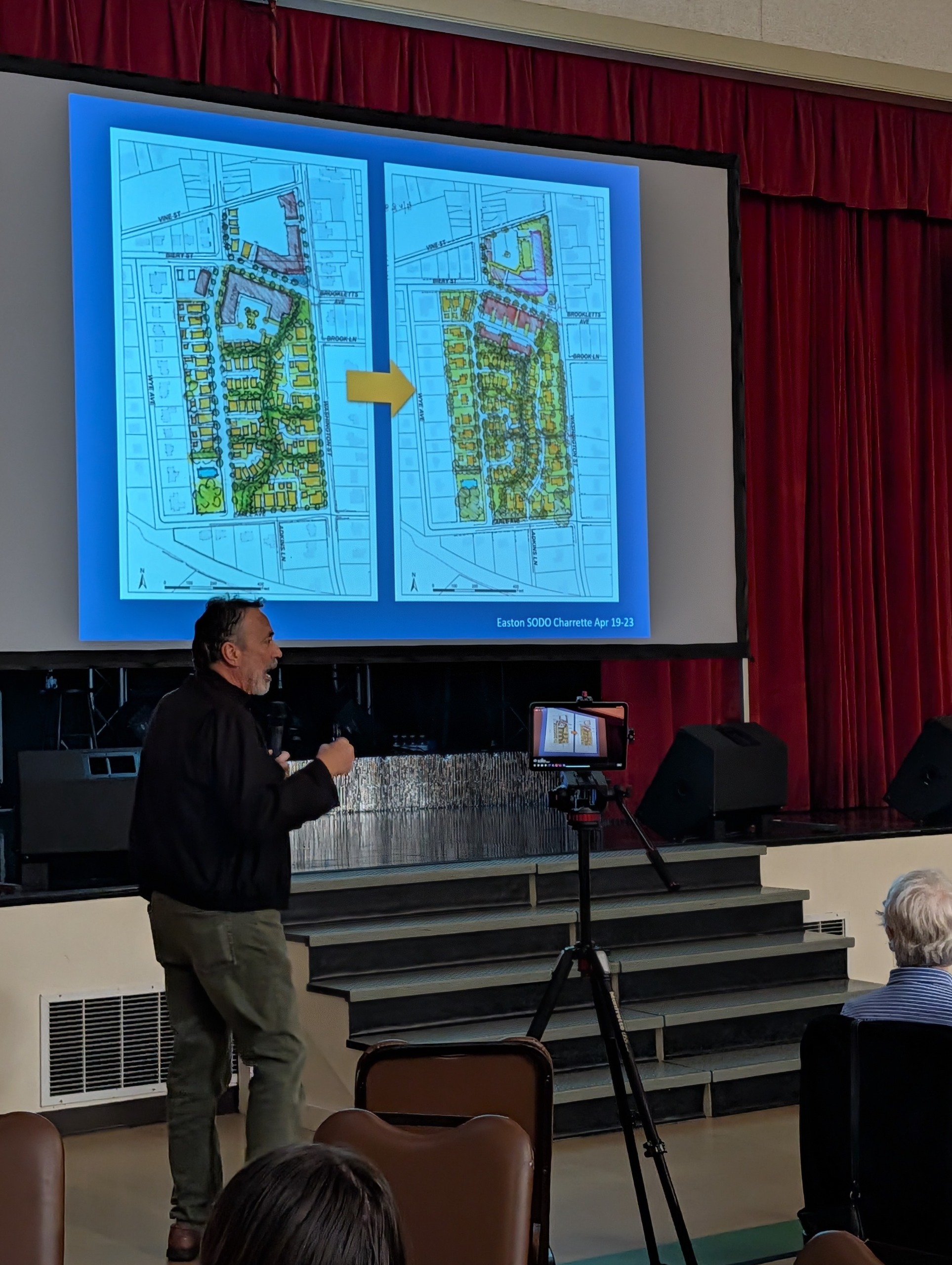
Approximately 70 people attended all or a portion of the Design Charrette! The Charrette began on Sunday, April 19th with stakeholder roundtables where, after the report-outs by each table, certain thematic overlaps occurred including a desire for open space, housing of a similar character along the perimeter of the site from the homes across S. Washington Street and Earle Avenue, and the reopening of the former north-south Adkins Street currently covered by the hospital. On Monday these themes were then consolidated, synthesized and translated into 5 development concepts. After feedback from the public on Monday evening (Pinup #1), the plans were further consolidated into two development scenarios where additional feedback was given by the public on Tuesday evening (Pinup #2). The design team then worked all day and evening on Wednesday and Thursday that culminated in the final development scenarios (Plan A and Plan B). The scenarios were presented Thursday evening.
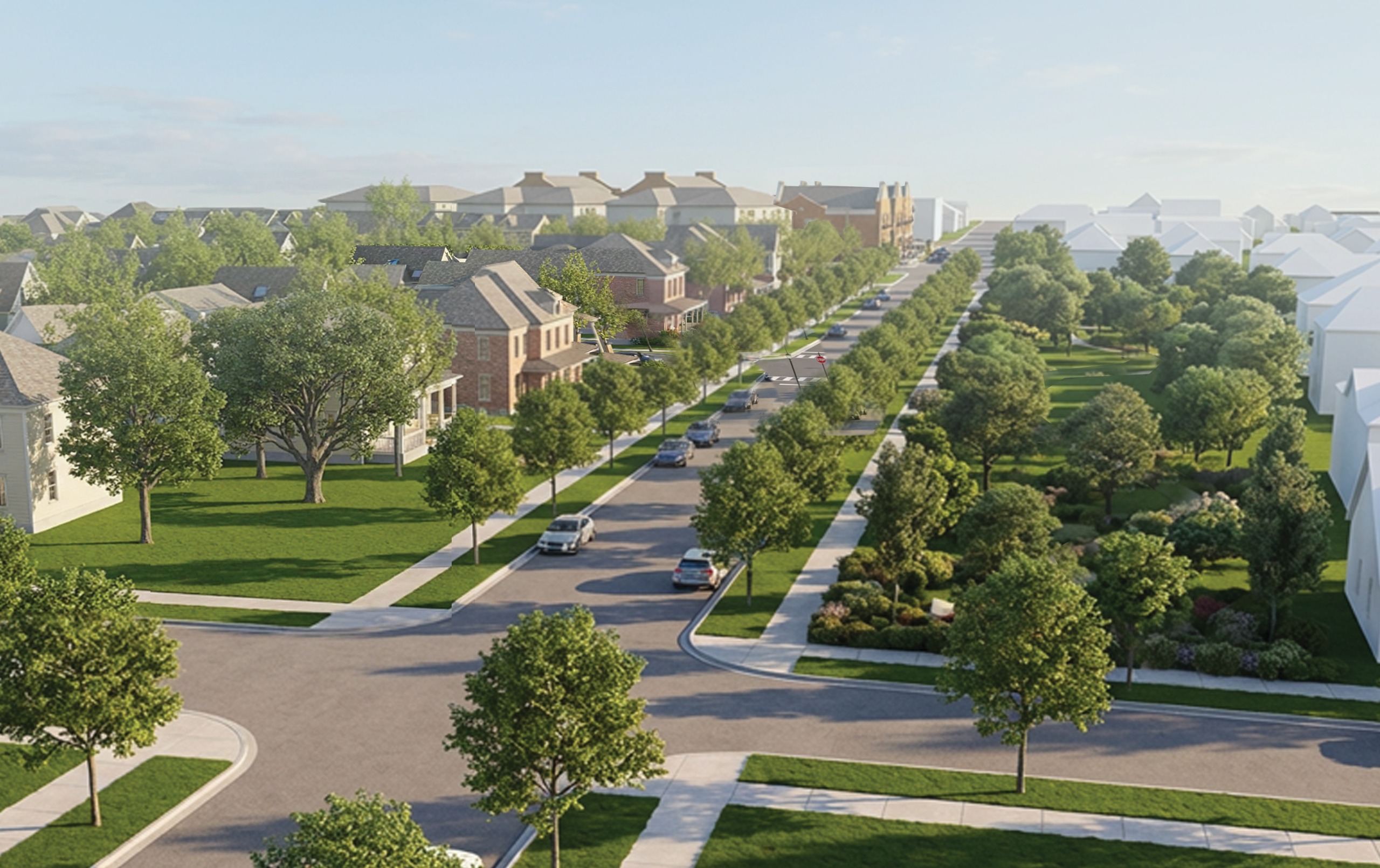
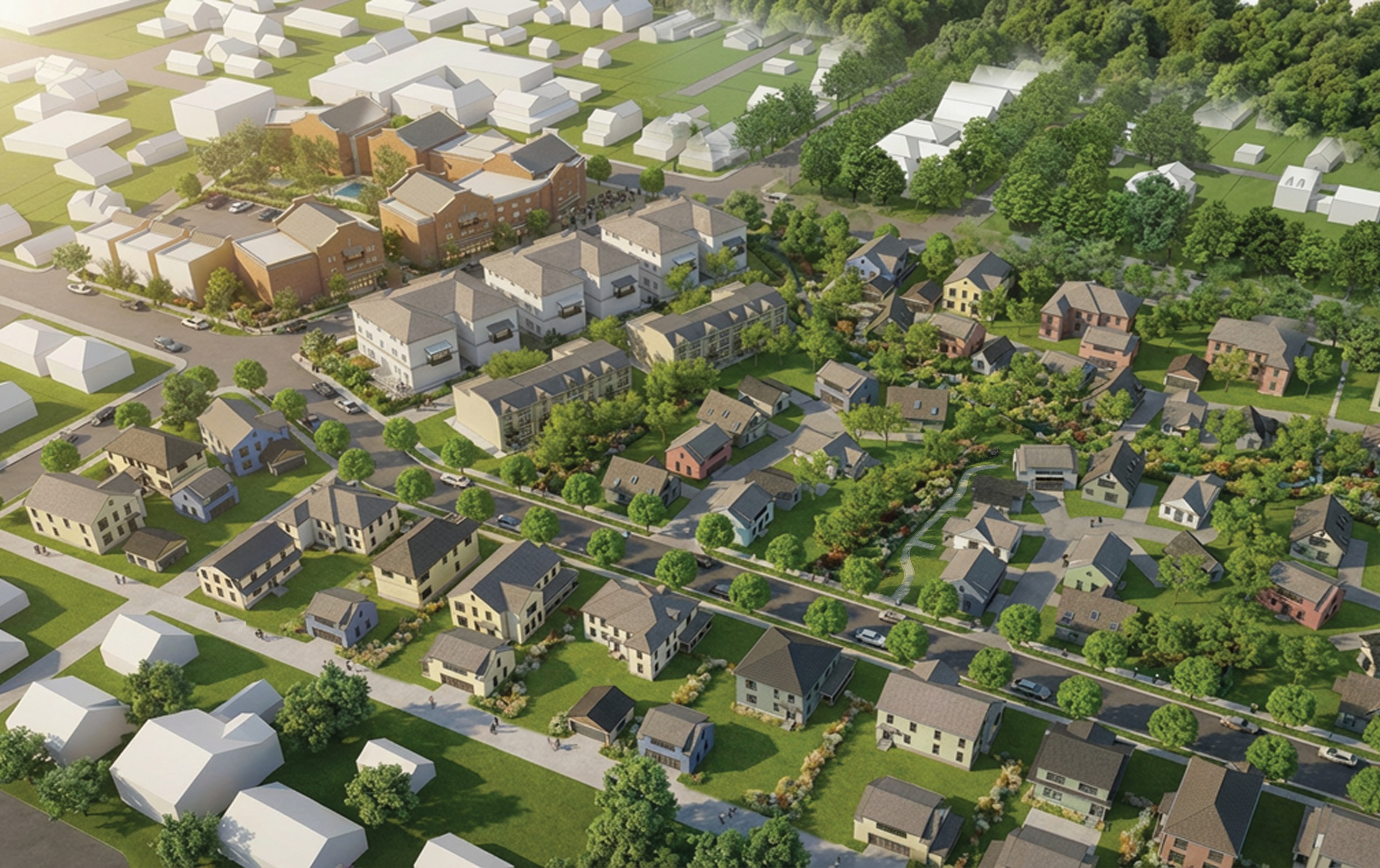
Both Plan A and Plan B are similar conceptually; the bulk of the higher density and commercial is on the northern portion of the site and closer to downtown with a transition to lower density and context sensitive design as the scenarios move further south. They are also consistent with comprehensive plan policies that support more affordable housing in Easton by providing affordable market-rate housing primarily through smaller footprint units and a greater variety of housing types. In addition, the market feasibility analysis conducted during the charrette determined there was market demand for everything shown at market-acceptable price points.
Please keep in mind Plans A and B show potential development scenarios on the approximately 12.5-acre site based in part on site conditions, neighborhood context, comprehensive plan policies, design team expertise, and public input. Components can be moved or replaced. For example, the commercial on the northern portion of the site could be replaced with a different type of commercial such as a medical-related use. Components of the two scenarios could also be combined.
You can watch a video of the closing night presentation below. You can also view in the tabs below (by day) the initial evening kick-off and the evolving concepts that culminated in the Thursday evening plans, with a site plan, description, and renderings of Plan A and Plan B. You can also provide feedback on the development scenarios under the Final Presentation tab.
Easton Memorial Hospital Site (SODO) Charrette Closing Night Presentation
Day One - Opening Night

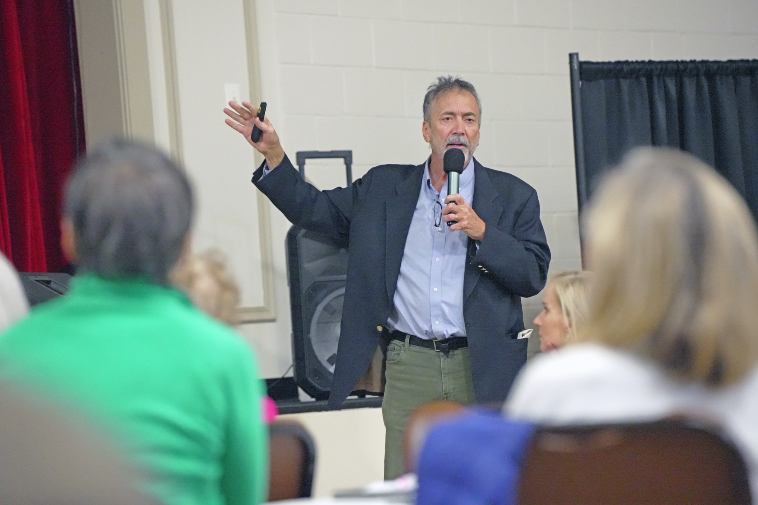
Thanks to everyone who came out to the Easton Memorial Hospital Site Charrette kickoff at Easton Church of God last night!
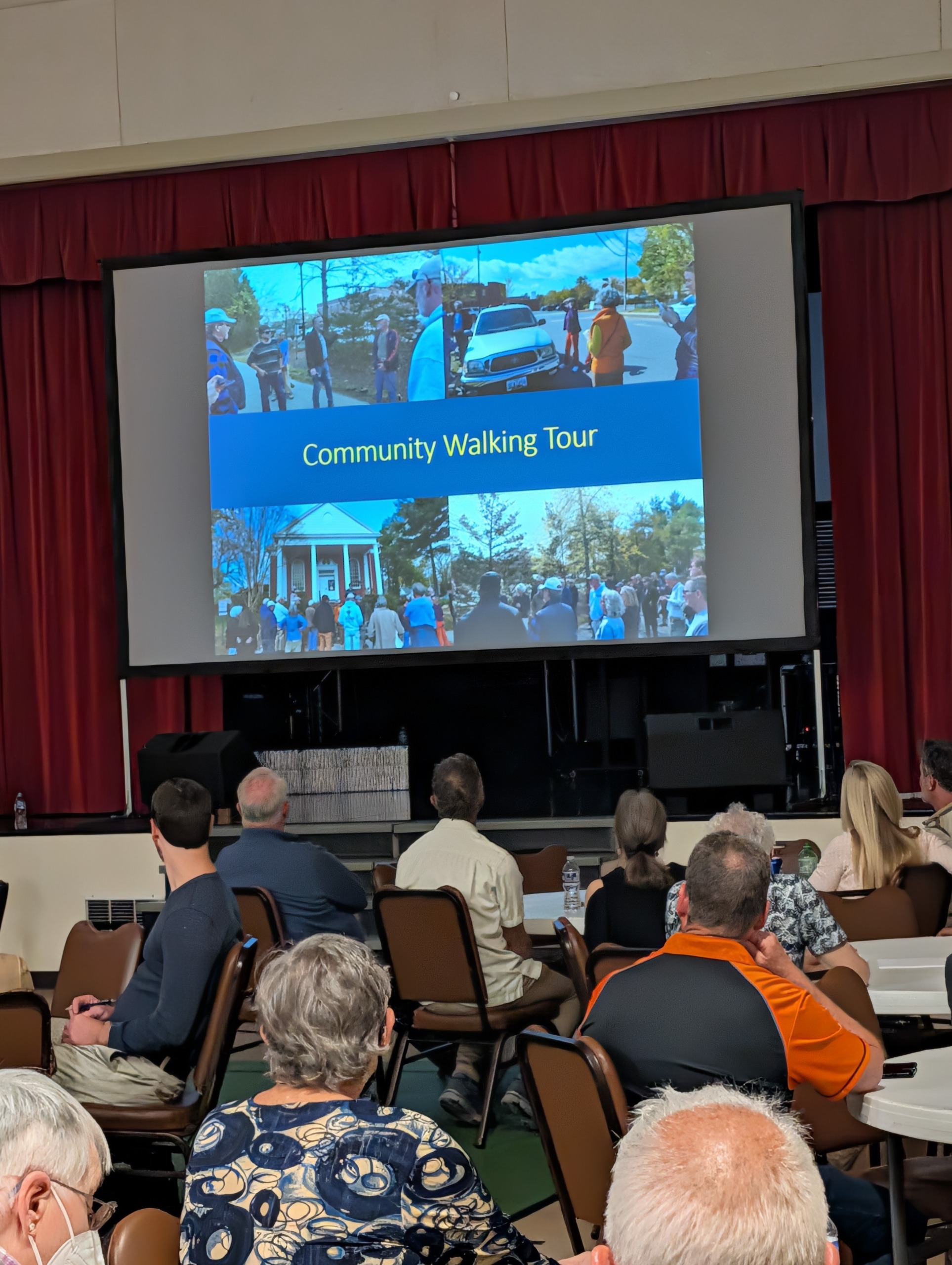
We had a very informative session led by Seth Harry & Associates who explained the situation, answered questions, and detailed why the charrette process, and public input are so important to the future of this project. Afterwards, groups broke out to brainstorm their own layouts for the 14-acre current hospital space, leading to creative ideas and thoughtful discourse throughout the night. While the kickoff was a great success, we still have more events to look forward to throughout the week.
As always, your input in this process is incredibly valuable and we hope to see you all there!
Day Two - Pinup #1
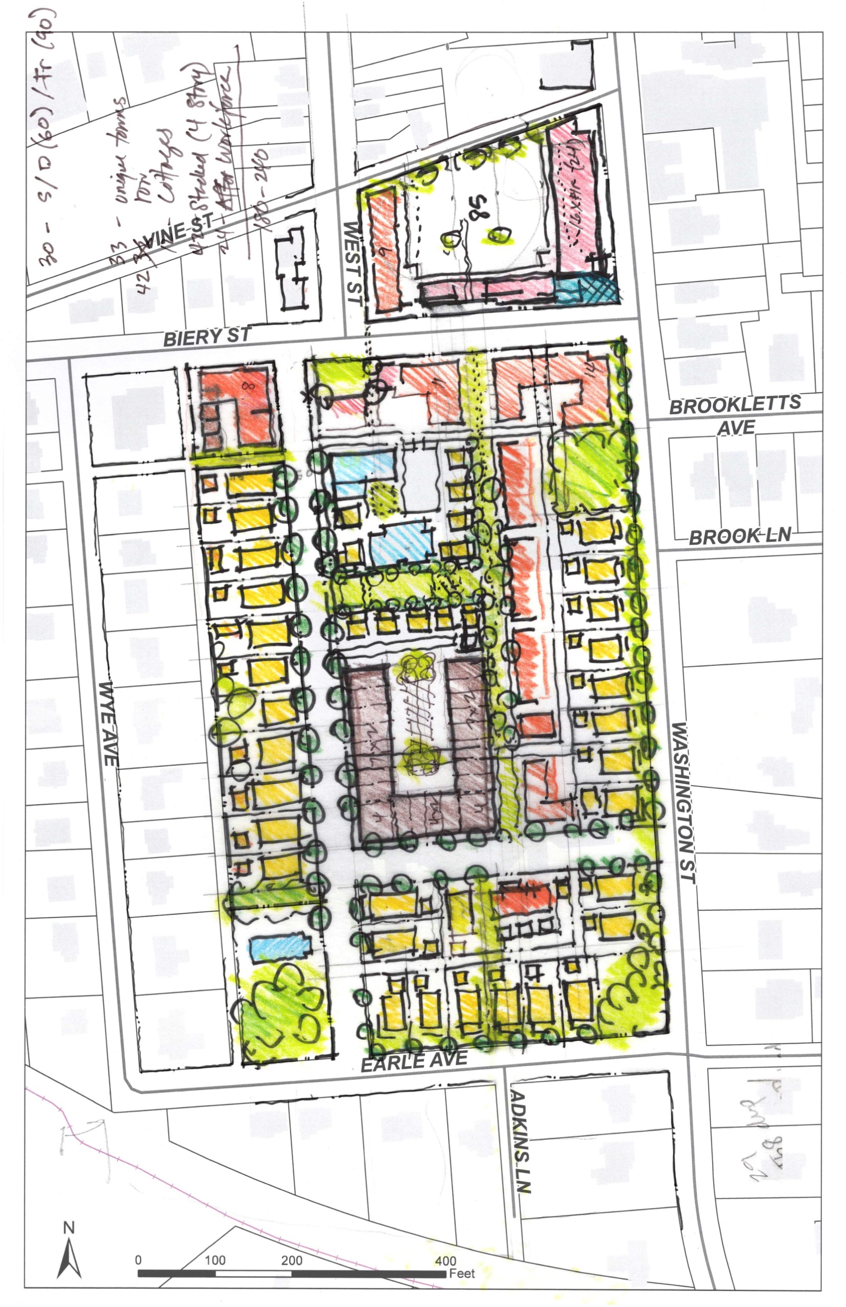
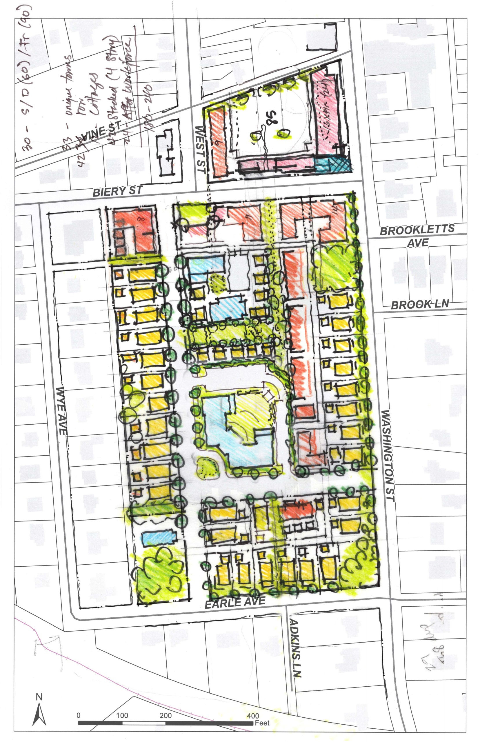
- Detached single family homes fronting along perimeter of site on Washington Street and Earle Avenue (max 3 floors) (yellow)
- Rebuilding of Adkins Street
- Detached single family homes fronting along AdkinsStreet, with alley-loaded garages along existing alleyway (ADUs possible above garages) (max 2.5 floors) (yellow)
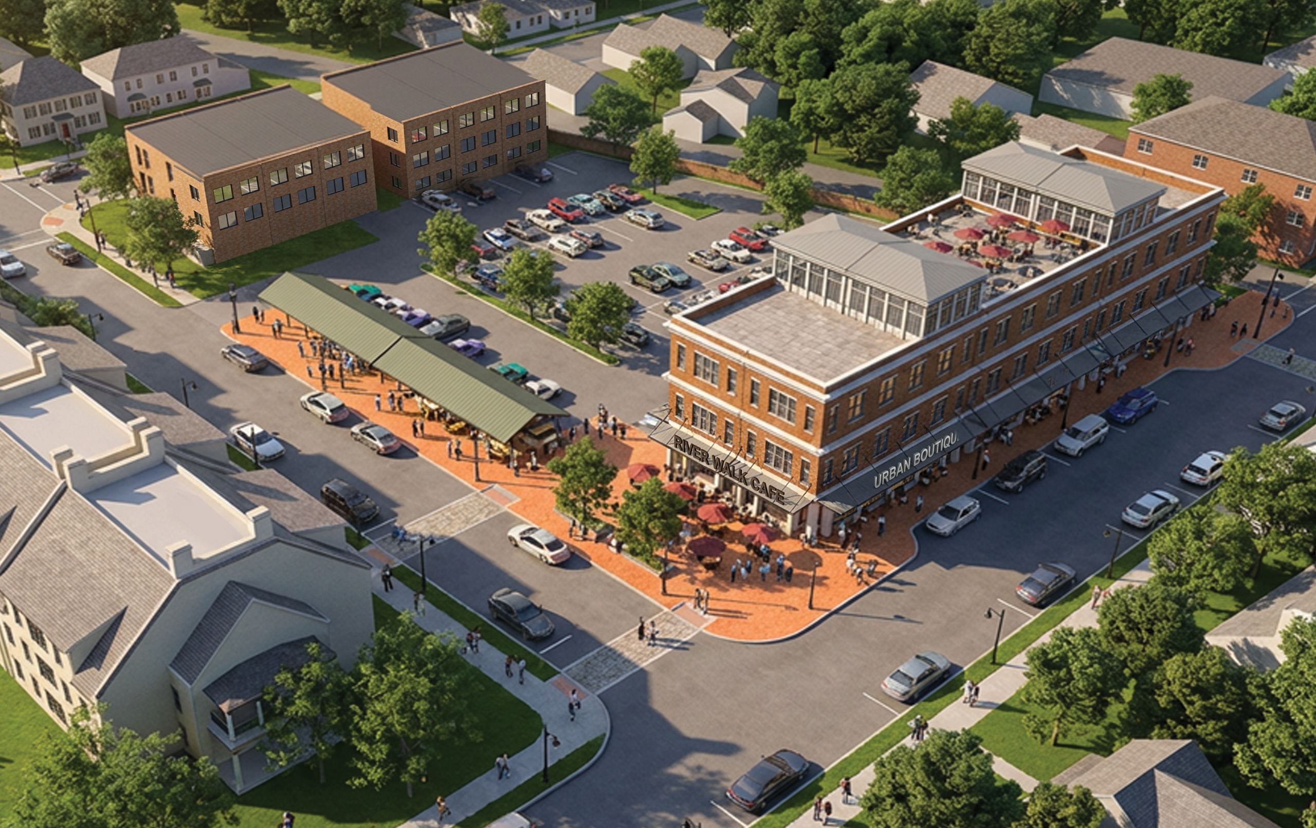
- Mixed-use apartment building on site of northern parking lot (red)
- New street connecting Adkins Street and Washington Street
- Pedestrian alley (green) between new street and Biery, and between new pedestrian alley and Adkins.
- Attached rowhomes fronting along new pedestrian alley (red)
- Cottage units along pedestrian alley and around preserved original hospital building (blue center)which is repurposed into a senior living facility
- Attached housing (3 floor max) on south side of Biery Street (light red)
- Four floor stacked duplexes (brown) around parking lot
- Detached single family homes fronting along perimeter of site on Washington Street and Earle Avenue (max 3 floors) (yellow)
- Rebuilding of Adkins Street
- Detached single family homes fronting along AdkinsStreet, with alley-loaded garages along existing alleyway (ADUs possible above garages) (max 2.5 floors) (yellow)
- Mixed-use apartment building on site of northern parking lot (red)
- Apartment building on south side of Biery Street (brown)
- Two new streets connecting Atkins Street and Washington Street
- Detached single family homes fronting along new streets and Adkins with rear alley-loaded garages and ADUs (yellow)
- Alley-loaded Carriage houses (orange)
Detached single family homes fronting along perimeter of site on Washington Street and Earle Avenue (max 3 floors) (yellow)
Rebuilding of Adkins Street
Detached single family homes fronting along Adkins Street, with alley-loaded garages along existing alleyway (ADUs possible above garages) (max 2.5 floors) (yellow)
Mixed-use apartment building on site of northern parking lot (red)
Apartment building on south side of Biery Street (brown)
Two new streets connecting Adkins Street and Washington Street
Detached single family homes fronting along new streets and Adkins with rear alley-loaded garages and ADUs (yellow)
Alley-loaded carriage houses (orange)
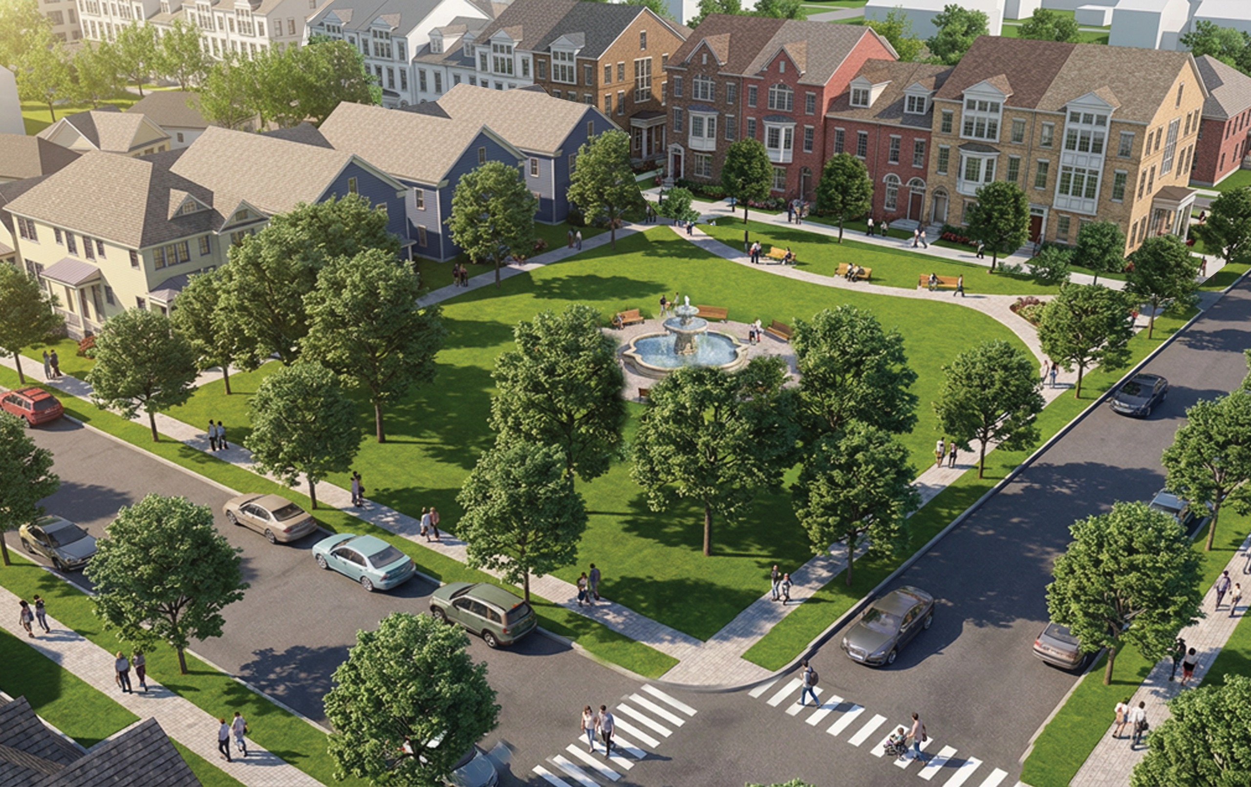
Large central community park / field (green)
- Detached single family homes fronting along perimeter of site on Washington Street and Earle Avenue (max 3 floors) (yellow)
- Rebuilding of Adkins Street
- Detached single family homes fronting along AdkinsStreet, with alley loaded garages along existing alleyway (ADUs possible above garages) (max 2.5 floors) (yellow)
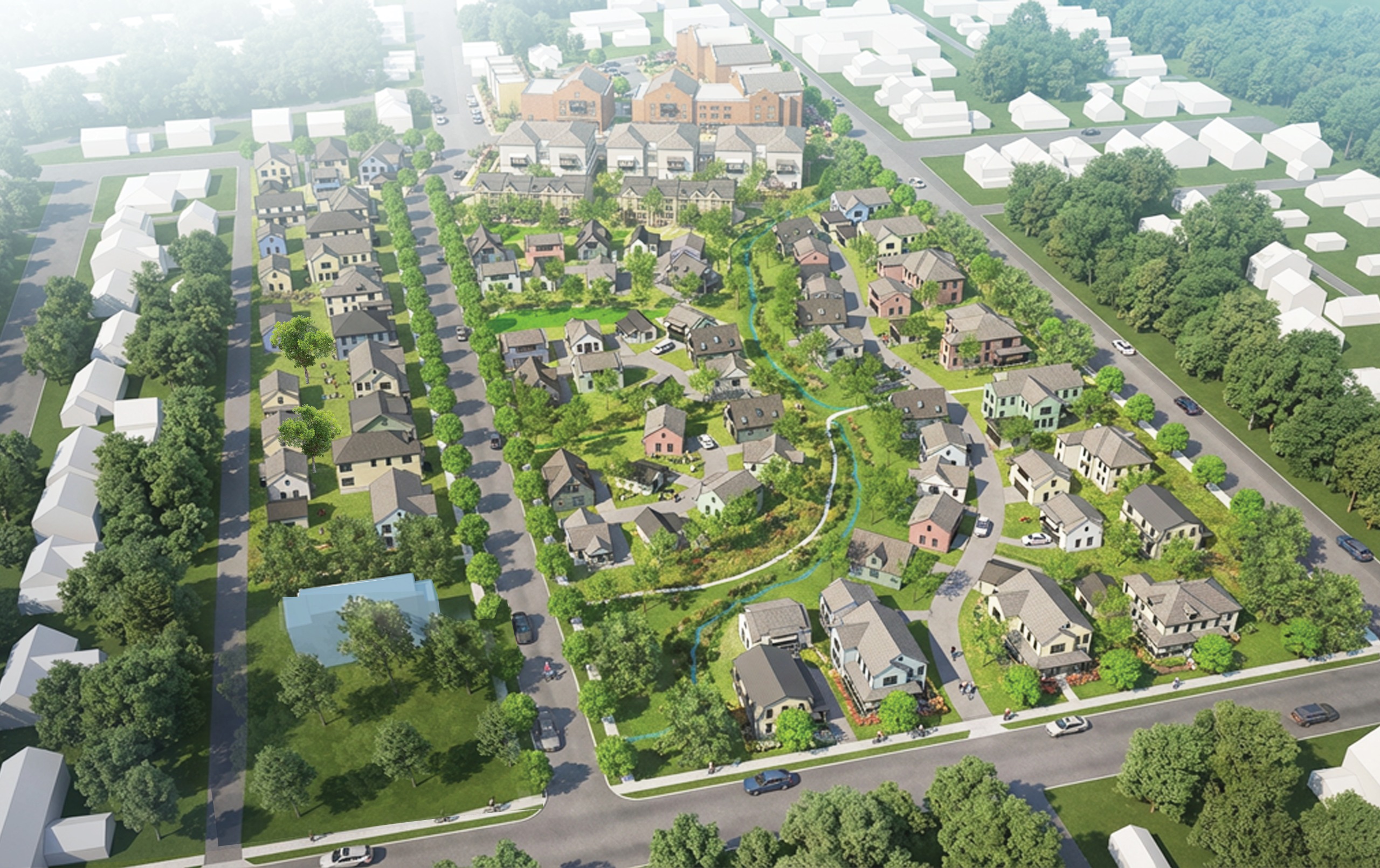
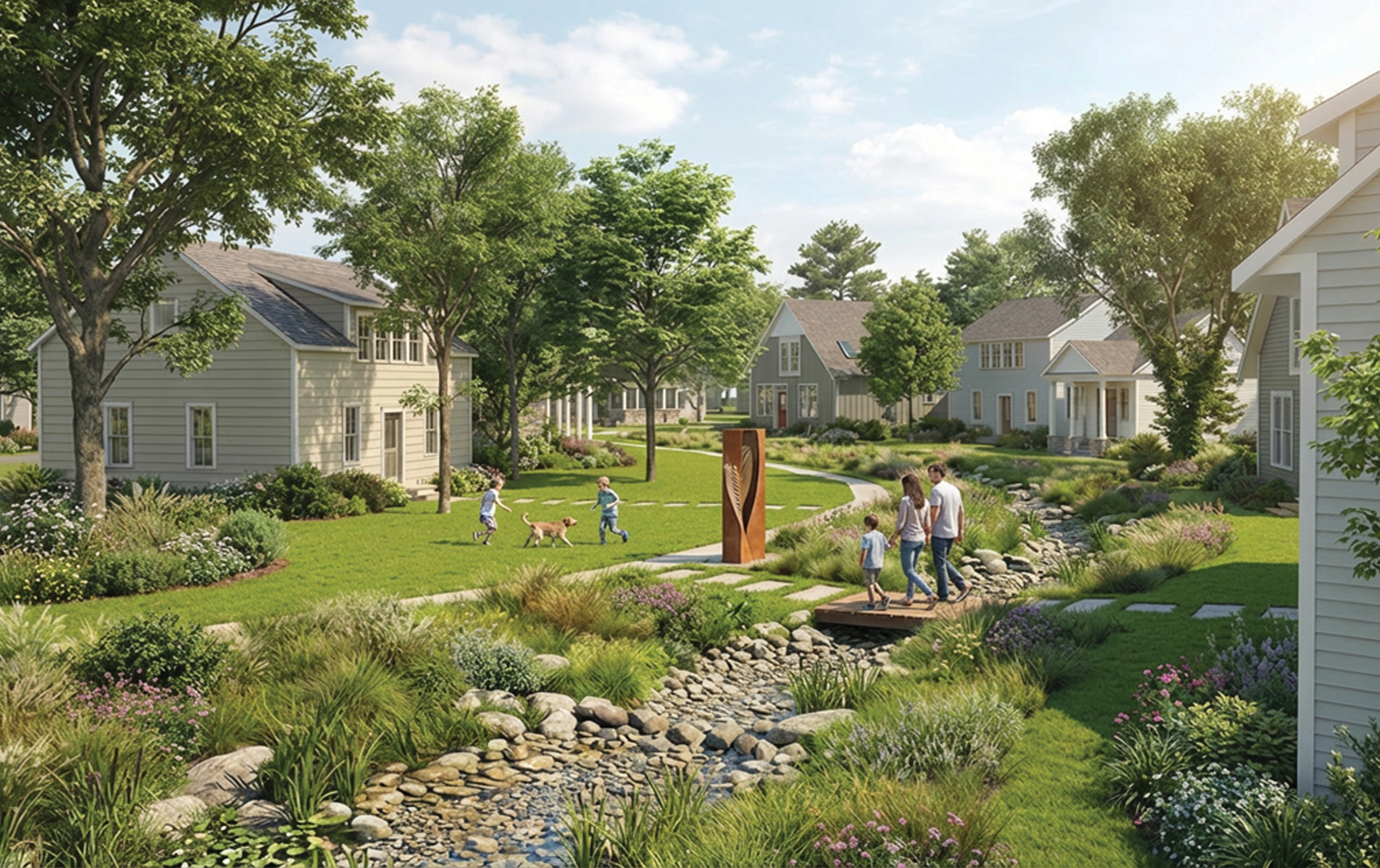
- Daylighting of existing stream through core of site, which is lined with pedestrian paths and restoredriverbanks and trees (dark green)
- Single family detached homes fronting onto stream paths with alley loaded parking in rear
- Realign Biery Street diagonally to connect directlywith Brookletts Avenue, between Adkins and Washington
- Multifamily apartment buildings (brown), with ground floor retail at eastern corners, along Biery Street
- Detached single family homes fronting along perimeter of site on Washington Street and Earle Avenue (max 3 floors) (yellow)
- Rebuilding of Adkins Street
- Detached single family homes fronting along Adkins Street, with alley-loaded garages along existing alleyway (ADUs possible above garages) (max 2.5 floors) (yellow)
- Mixed-use apartment building on site of northern parking lot (red)
- New street connecting Adkins Street and Washington Street
- Pedestrian alley (green) between new street and Biery, and between new pedestrian alley and Adkins
- Attached rowhomes fronting along new pedestrian alley (red)
- Cottage units along pedestrian alley and around preserved original hospital building (blue center) which is repurposed into a senior living facility
- Attached housing (3 floor max) on south side of Biery Street (light red)
- Hotel (blue) at center (max 4 floors)
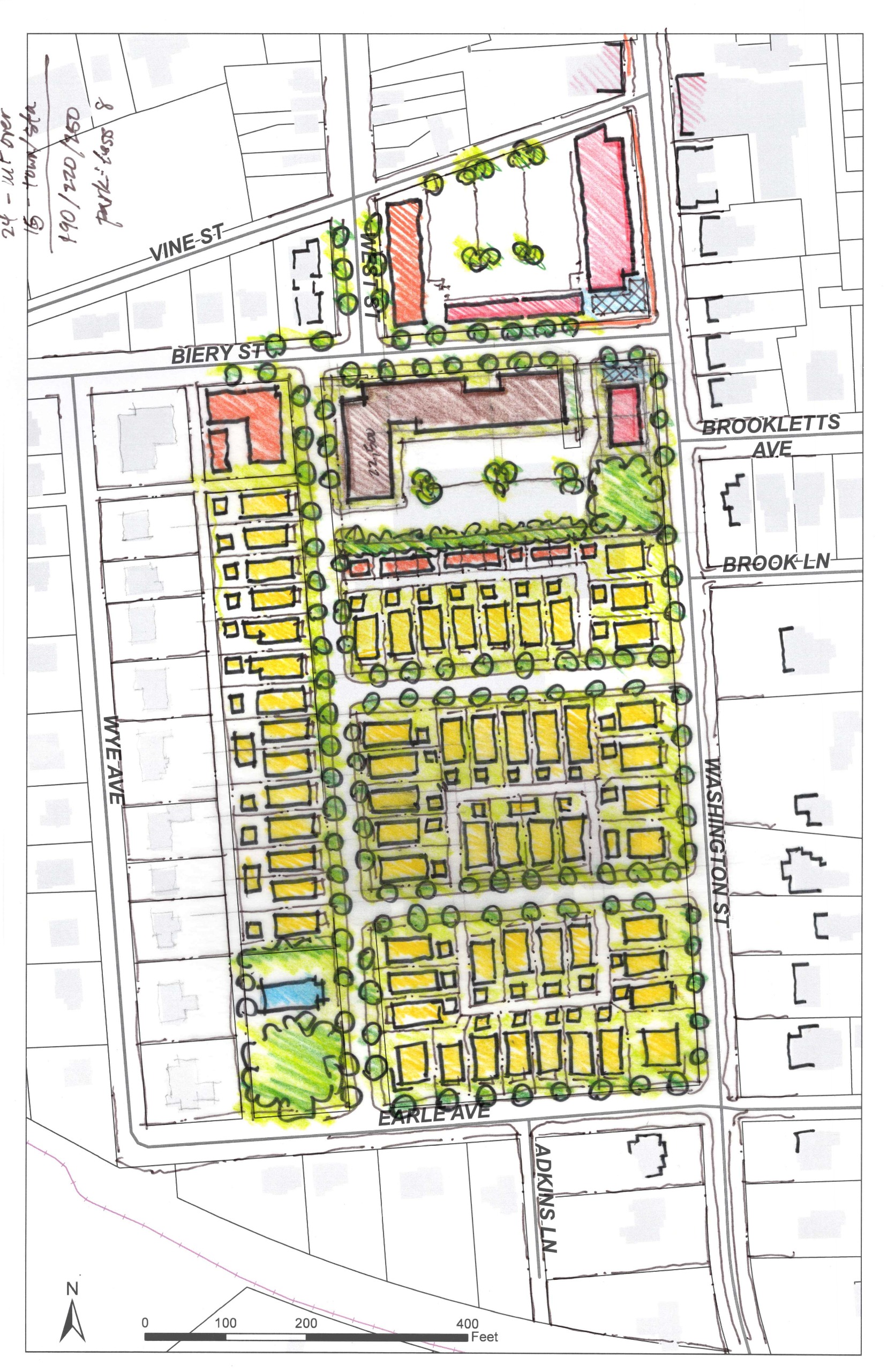
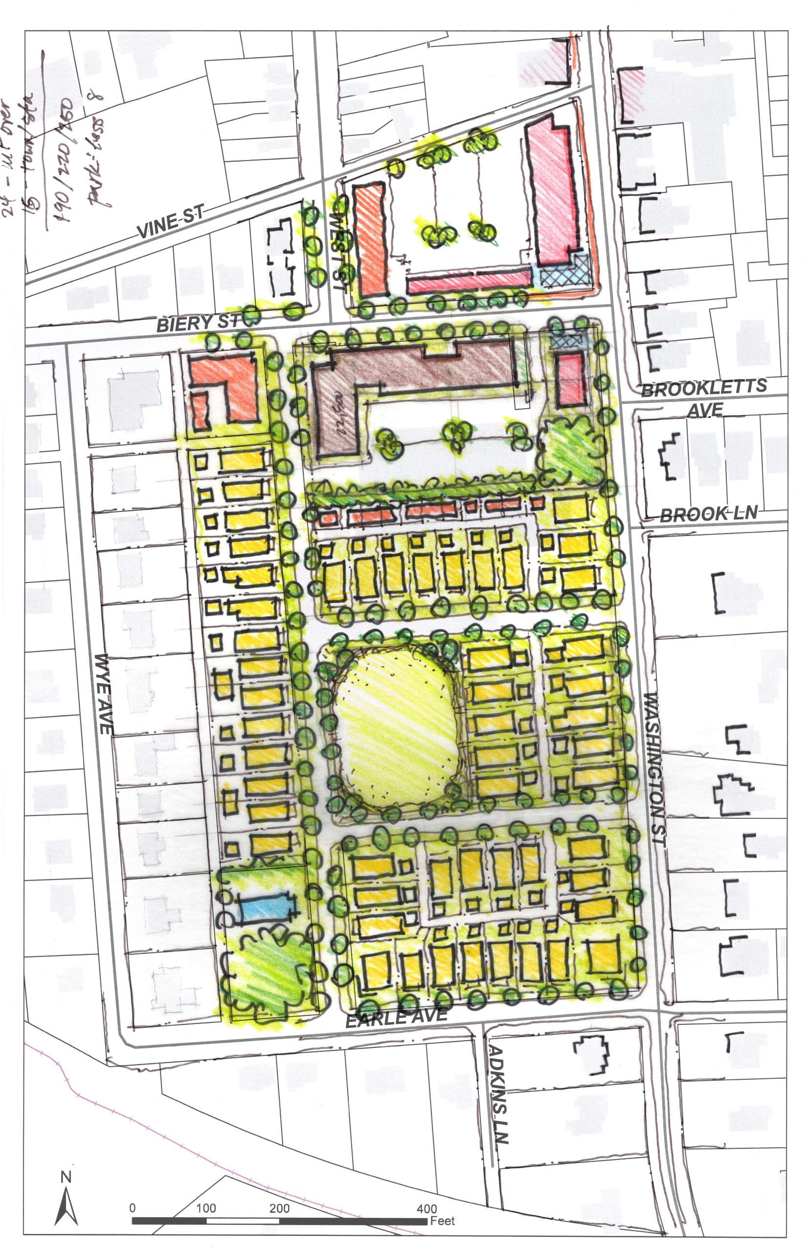
Day Three - Pin up #2
- Detached single family homes fronting along perimeter of site on Washington Street and Earle Avenue (max 3 floors) (yellow)
- Rebuilding of Adkins Street
- Detached single family homes fronting along Adkins Street, with alley-loaded garages along existing alleyway (ADUs possible above garages) (max 2.5 floors) (yellow)
- Mixed-use apartment building on site of northern parking lot (red)
- New street connecting Adkins Street and Washington Street
- Pedestrian alley (green) between new street and Biery, and between new pedestrian alley and Adkins
- Attached rowhomes fronting along new pedestrian alley (red), with alley loaded parking in rear
- Cottage units around preserved original hospital building (blue center) which is repurposed into a senior living facility, in center of greenspace
- Attached housing (3 floor max) on south side of Biery Street (light red)
- Open green space at intersection of Adkins and new street
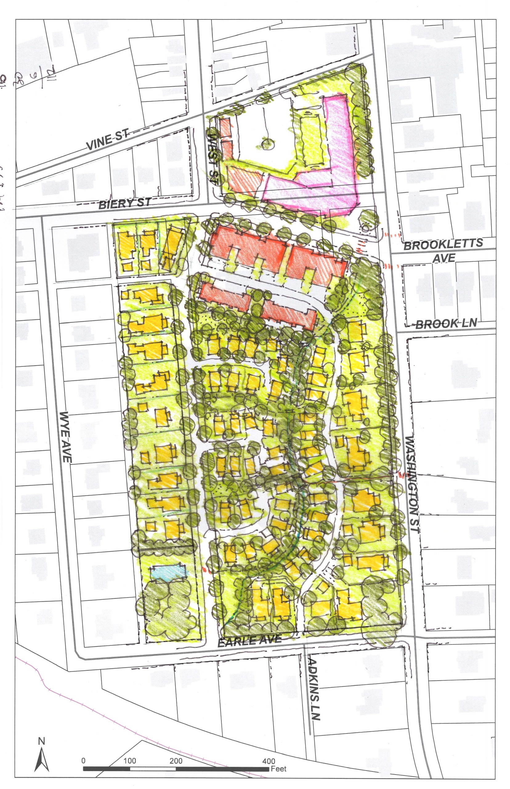
- Detached single family homes fronting along perimeter of site on Washington Street and Earle Avenue (max 3 floors) (yellow)
- Rebuilding of Adkins Street
- Detached single family homes fronting along Adkins Street, with alley loaded garages along existing alleyway (ADUs possible above garages) (max 2.5 floors) (yellow)
- Wooded linear corridor through core of site, which is lined with pedestrian paths and trees (dark green)
- Single family detached homes (cottages) fronting onto wooded corridor paths with alley loaded parking in rear (yellow)
- New alley from Adkins Street to Earle Avenue.
- Realign Biery Street diagonally to connect directly with Brookletts Avenue, between Adkins and Washington
- Mansion Flats with alley loaded parking in rear along south side of Biery Street and new alley (3 floors max) and along West Street (red)
- Mixed use building or hotel on north side of Biery Street (pink) with rear loaded parking lot
Day Five - Final Presentation
Features include:
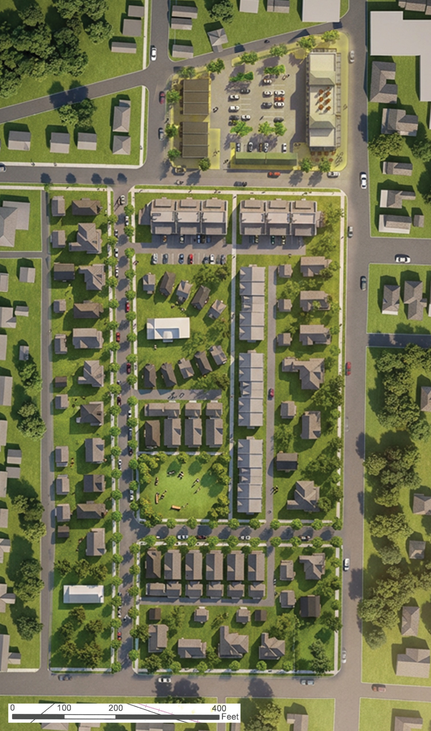
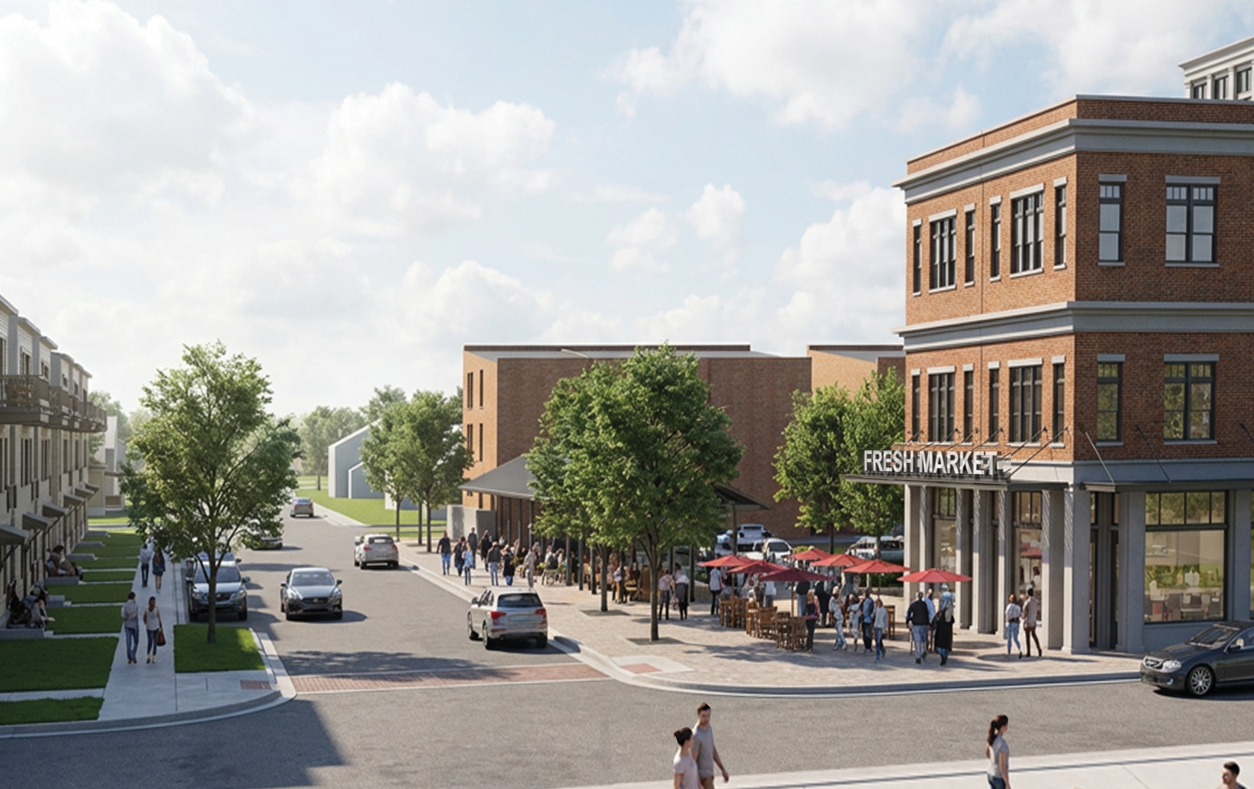
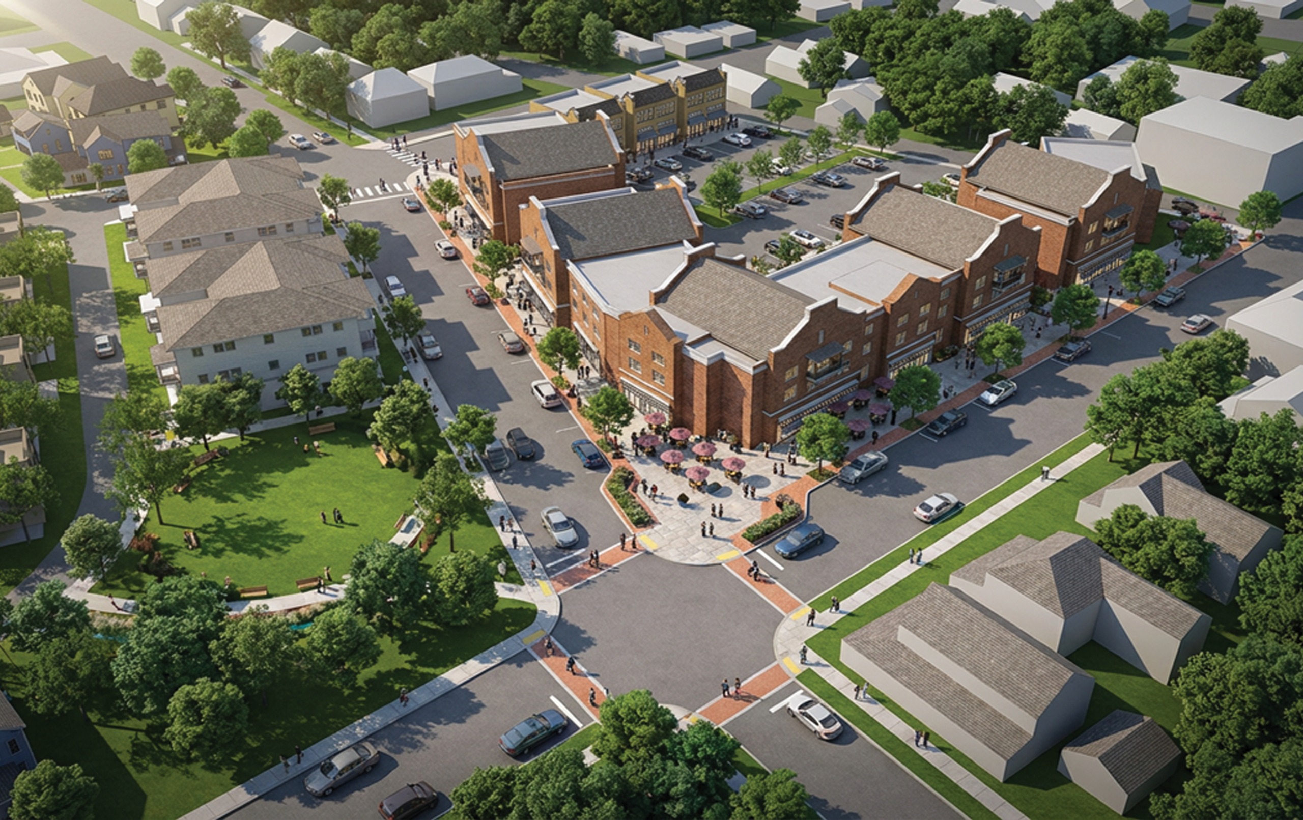
- 12,000 sq. ft. local serving, specialty grocer on the ground floor with a seasonal outdoor market on the northern parking lot site with 2 stories of residential above
- Multi-Family apartment building on the northern parking lot site (west side)
- Larger lot, Single-Family Detached homes with larger setbacks on the perimeter of the site (Accessory Dwelling Units possible above alley-loaded garages) adjacent to S. Washington Street and West Earle Avenue
- Smaller Single-Family Detached homes with alley loaded garages in the interior of the site
- Rebuilding of a north-south Adkins Street to the west of Wye Avenue to create a full block
- Single-Family Detached homes fronting along Adkins Street, with alley-loaded garages along existing alleyway (Accessory Dwelling Units possible above garages) (max 2.5 floors)
- New east-west street connecting Adkins Street and S. Washington Street
- Pedestrian alley between the new east-west street and Biery Street, and between the new pedestrian alley and Adkins Street
- Attached Townhomes fronting along the new north-south pedestrian alley with alley loaded parking in rear
- 1 to 1 1/2 story Cottage units around the preserved original hospital building in the center green which can be repurposed into a senior living facility
- Stacked Fourplex housing or mansion flats (3 floor max) on the south side of Biery Street
- Formal green at the intersection of Adkins Street and the new east-west street
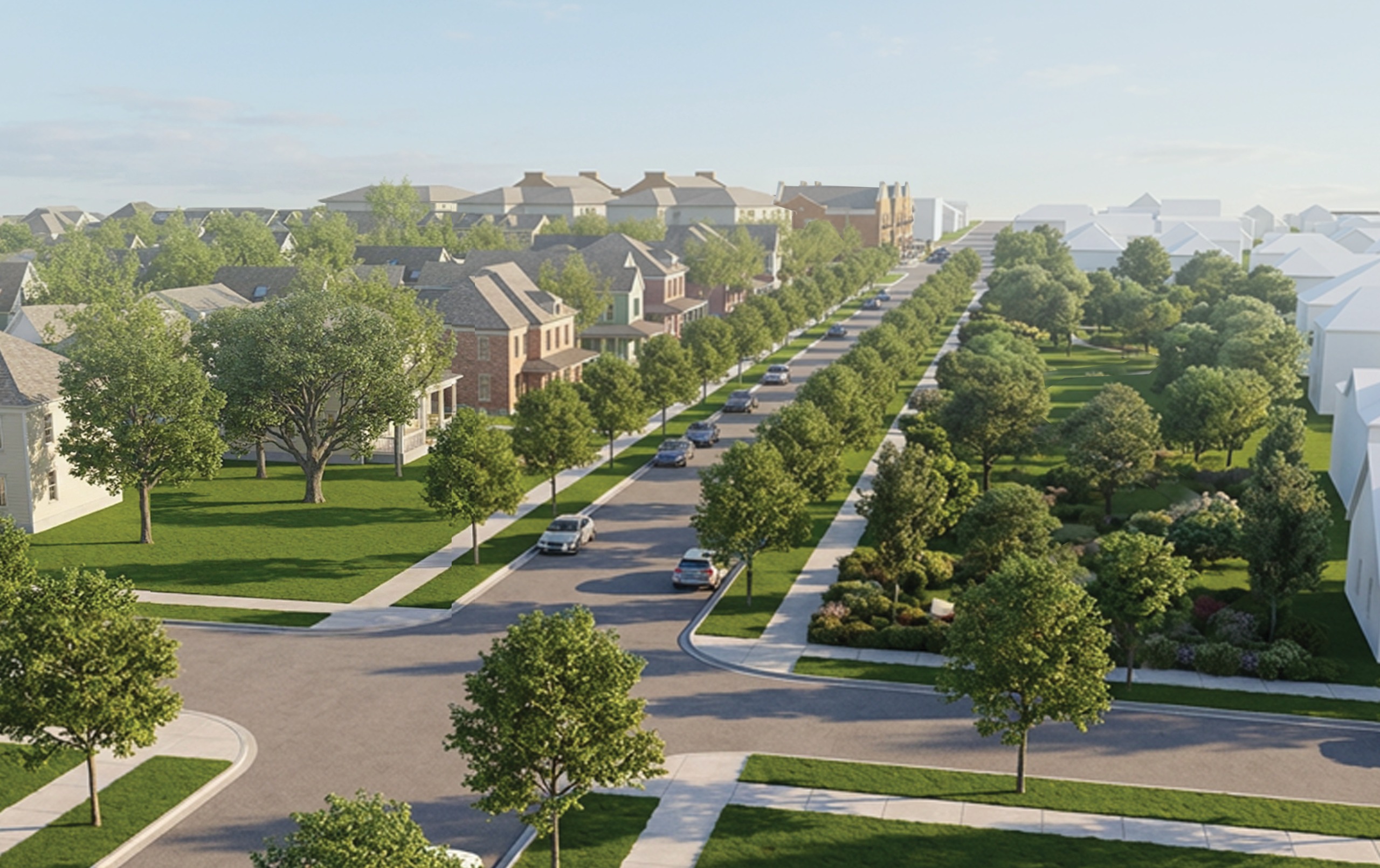
- Mature trees saved and incorporated into the site design
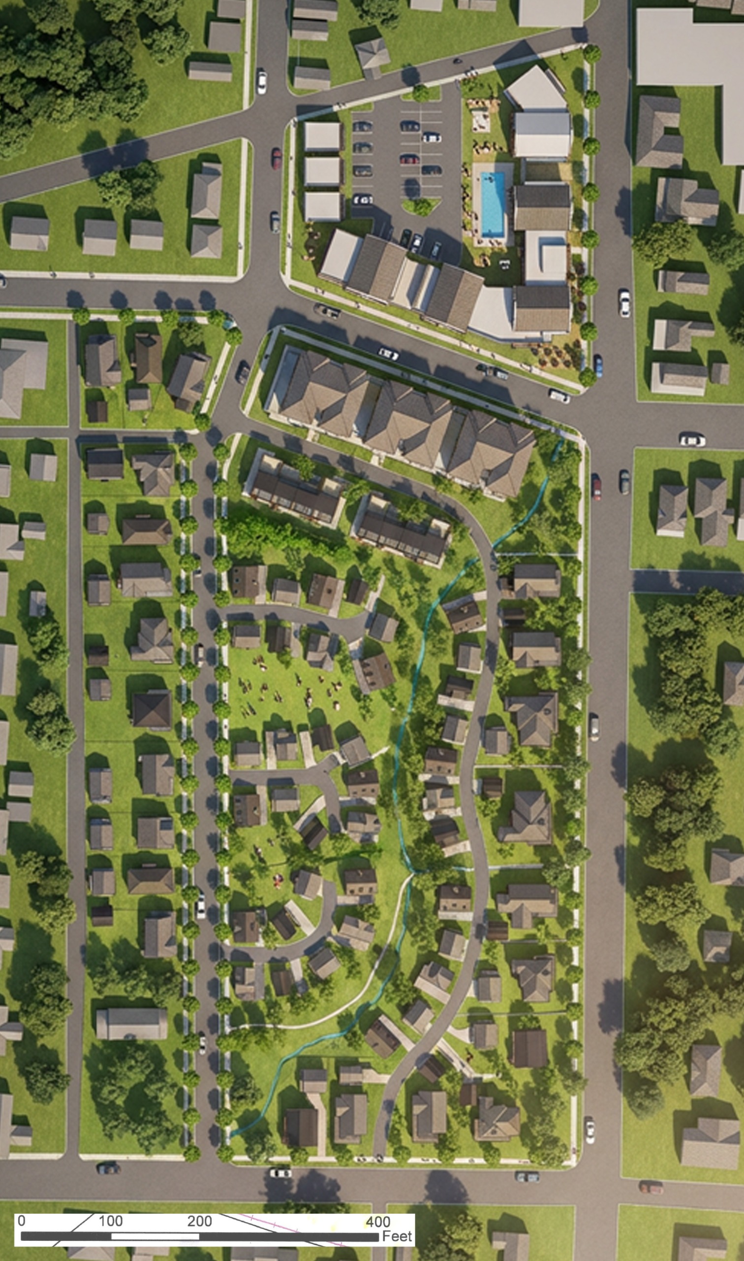
- This plan can generate anywhere from 135 to 175 units. For comparison purposes:
- The underlying zoning (R-7A and R-10A) can generate up to 100 dwelling units by-right (going straight to building permit) with Single-Family Detached and Duplexes
- The underlying zoning (R-7A and R-10A) can generate between 100 -150 dwelling units by Special Exception (review and approval by the Board of Zoning Appeals) with Single-Family Detached, Duplexes, and Middle Housing
- The underlying zoning (R-7A and R-10A) can generate between 150 to 250 dwelling units by Special Exception (review and approval by the Board of Zoning Appeals) with Single-Family Detached, Duplexes, Middle Housing, and Multi-Family
- The underlying zoning (R-7A and R-10A) can generate between 200 to 400 dwelling units by Planned Unit Development (review and approval by the Town Council) with Single-Family Detached, Duplexes, Middle Housing, Multi-Family, and Mixed-Use
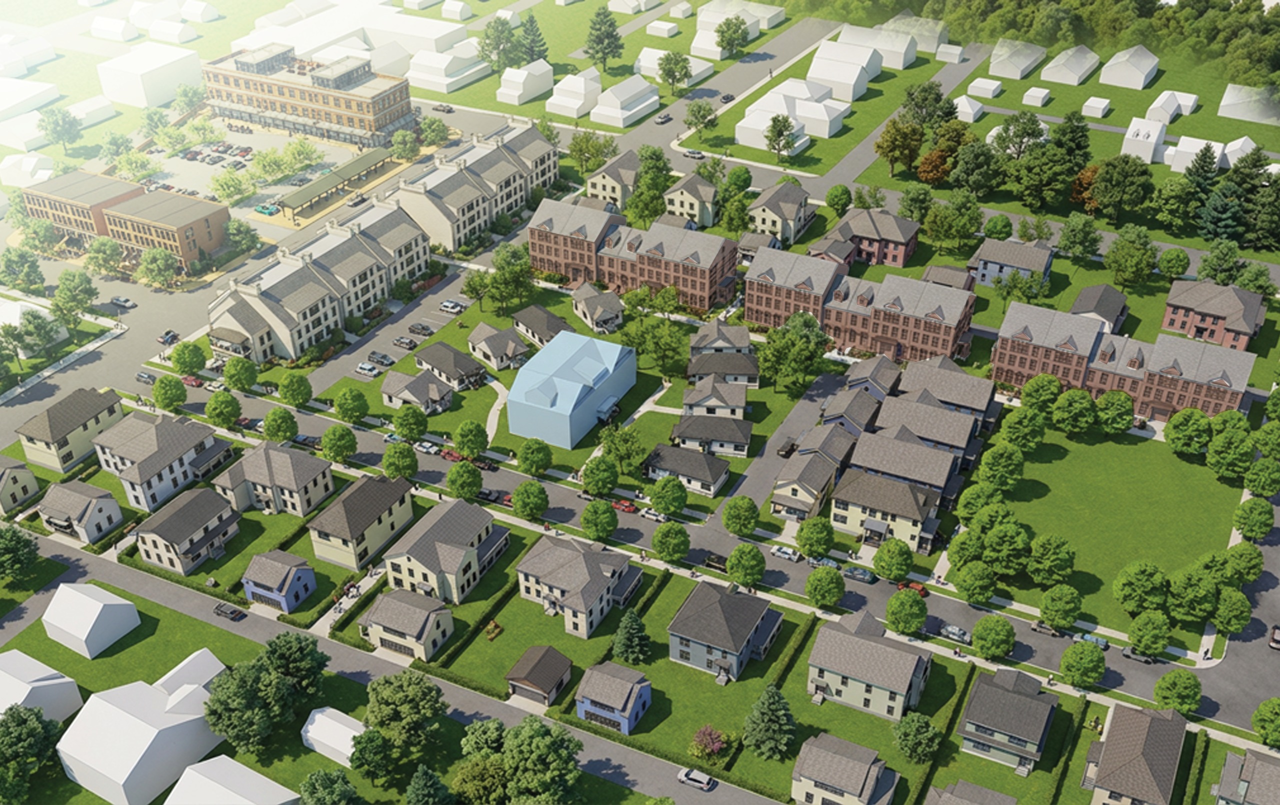
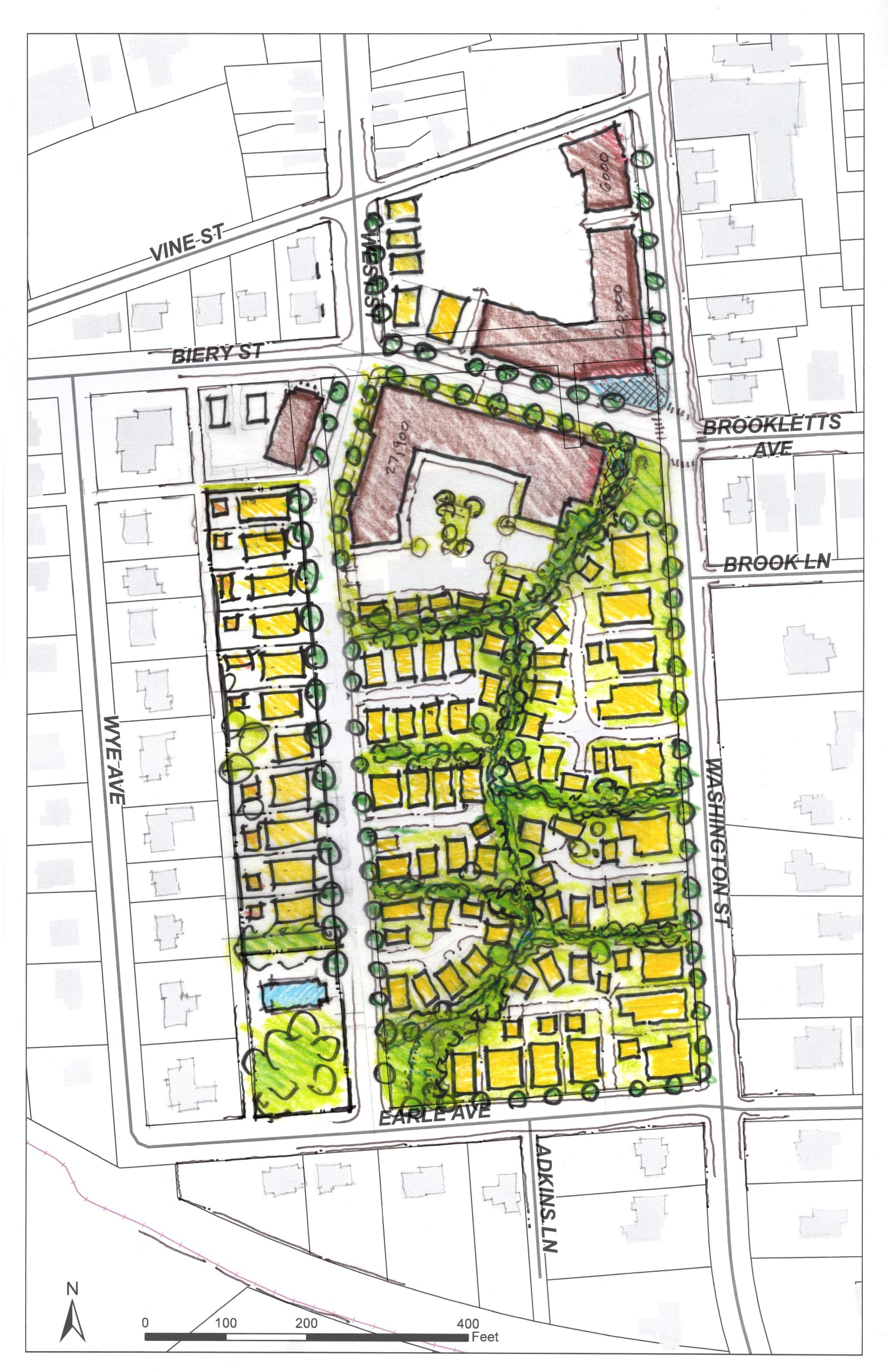
Features include:
- Realignment of Biery Street diagonally to connect directly with Brookletts Avenue, between Adkins Street and S. Washington Street, resulting in the elimination of a skewed intersection and the creation of a larger block on the northern parking lot site for more commercial options
- 20,000 sq. ft. of ground floor commercial on the northern parking lot site with 2 stories of residential above
- Large Single-Family Detached, Stacked Townhomes, or Mansion Flats on the northern parking lot site (west side)
- Rebuilding of a north-south Adkins Street to the west of Wye Avenue to create a full block
- Larger lot, Single-Family Detached homes with larger setbacks on the perimeter of the site (Accessory Dwelling Units possible above alley-loaded garages) adjacent to South Washington Street and West Earle Avenue
- Single-Family Detached homes fronting along Adkins Street, with alley-loaded garages along existing alleyway (Accessor Dwelling Units possible above garages) (max 2.5 floors)
- Mansion Flats with alley loaded parking in the rear along the south side of Biery Street and new alley (3 floors max) and along West Street
- Alley-loaded Townhomes just to the south of the Mansion Flats where the alley then transitions to a lane with more naturalistic landscaping that allows for a range of housing types in a range of settings
- Elimination of the new east-west street connecting Adkins Street and Washington Street in Plan A and any curb cuts along S. Washington Street
- Partial daylighting of an underground stream currently managed by stormwater pipes that carry a significant amount of volume by taking some of the on-site storm drainage and putting it into an above-ground bioswale and creating a wooded linear corridor through the core of site, which is lined with pedestrian paths and trees. This option reduces the impermeable surface and connects to more green space, creating both a visual and recreation amenity.
- Smaller single-Family Detached homes or Cottages fronting onto wooded corridor paths with alley loaded parking in rear
- 1 to 1 1/2 story Cottage units around a large and formalized center green
- Footpaths to the creek from S. Washington Street
- Path through the block that connects to the former synagogue with the structure remaining as a community events center with outdoor events
- Mature trees saved and incorporated into the site design
- Possibility of a small park at the corner of Brookletts Avenue and S. Washington Street by the elimination of the most eastern Mansion Flat
- This plan can generate anywhere from 145 to 185 units. For comparison purposes:
- The underlying zoning (R-7A and R-10A) can generate up to 100 dwelling units by-right (going straight to building permit) with Single-Family Detached and Duplexes
- The underlying zoning (R-7A and R-10A) can generate between 100 -150 dwelling units by Special Exception (review and approval by the Board of Zoning Appeals) with Single-Family Detached, Duplexes, and Middle Housing
- The underlying zoning (R-7A and R-10A) can generate between 150 to 250 dwelling units by Special Exception (review and approval by the Board of Zoning Appeals) with Single-Family Detached, Duplexes, Middle Housing, and Multi-Family
- The underlying zoning (R-7A and R-10A) can generate between 200 to 400 dwelling units by Planned Unit Development (review and approval by the Town Council) with Single-Family Detached, Duplexes, Middle Housing, Multi-Family, and Mixed-Use
Recorded Public Feedback
BACKGROUND
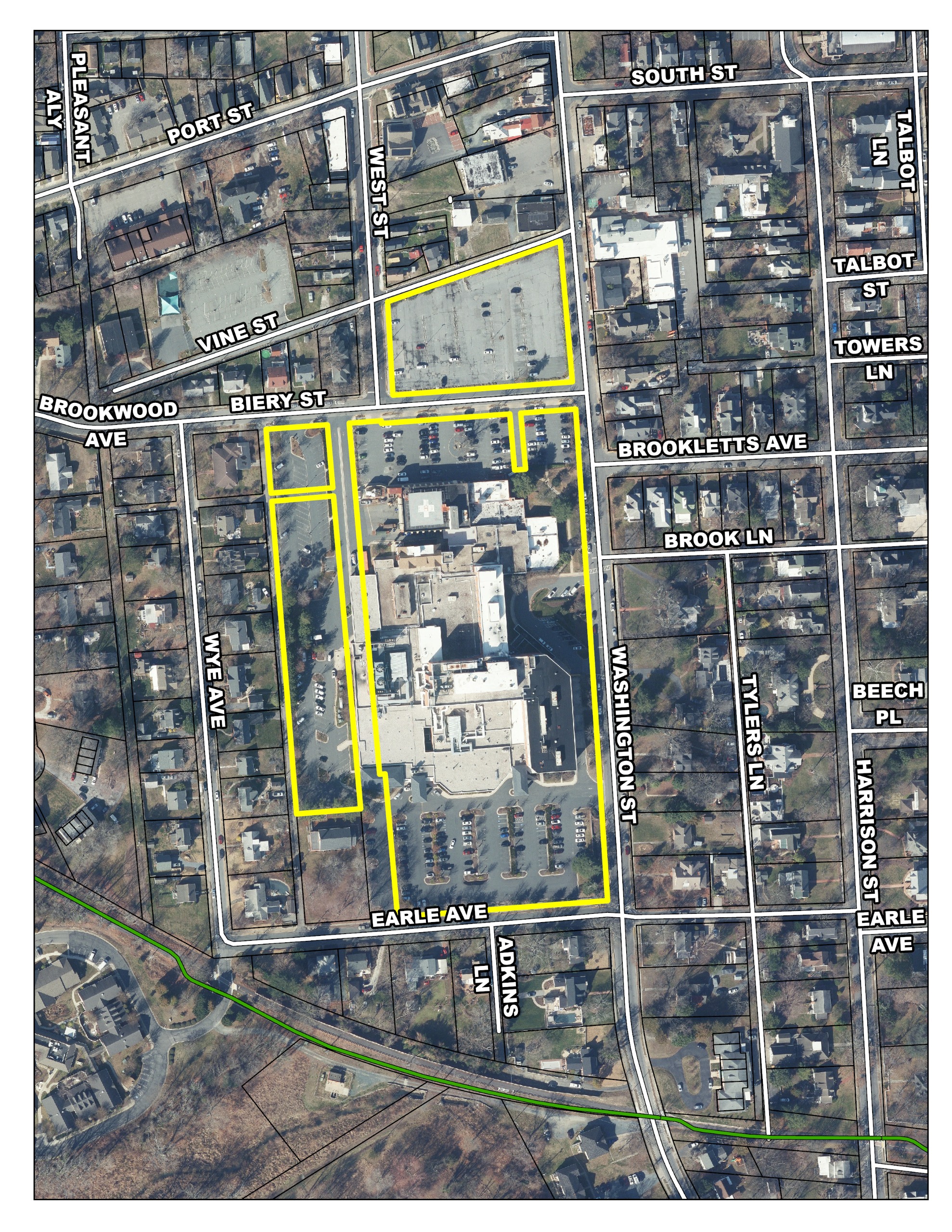
Easton faces a pivotal opportunity with the upcoming relocation of the UMMS Shore Medical Center hospital from its south downtown location to a new facility off Route 50. The current 12.5-acre site, a fixture since 1915, is a significant, centrally located property owned by UMMS and located adjacent to the central business district, middle housing, multi-family residential, and single-family residential housing. UMMS has solicited bids to private developers to purchase the site for acquisition and redevelopment.
The relocation of the medical center offers a transformative opportunity to bridge Easton’s historic downtown with its surrounding residential fabric. The Town of Easton is dedicated to the embodiment of Sustainable and Smart Growth Principles to strengthen, revitalize, and build upon an authentic and vibrant Town. Furthermore, early and active public participation has been a hallmark of planning processes in Easton for at least the past 30 years.
The Town selected the consultant team of Seth Harry & Associates (lead), Townscape Design, LLC and The Chesapeake Group to develop a South Downtown (SODO) Subarea Plan for the site of the soon-to-be-vacated property. The Subarea Plan will be the newest addition to Easton’s ongoing efforts to supplement the Town’s Comprehensive Plan with detailed small area plans for selected neighborhoods and corridors. This project will involve the neighborhood and the larger community, anchored by a multi-day public design charrette that was conducted from April 19th through the 23rd, in determining what are the most appropriate redevelopment scenarios for a key site that links Downtown Easton and surrounding historic neighborhoods.
Please continue to visit this site to also track the progress of this initiative, receive updates, and view documents. Better yet, register with Engage Easton by clicking the join button and follow this project to receive automatic updates as it develops.